
This Artist Is Fighting Gentrification With Murals

Fleeing War-Torn Homes for Crippling Rents—California Housing Costs Creating Harsh Reality for Refugees

Take LACMA and Put It In South L.A.? Great Idea

The Sensory City Philosopher

What Cities Do Right to Integrate Immigrants, in 4 Charts
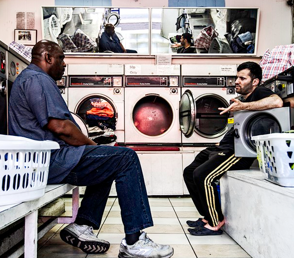
Launderettes of London

Lounge in Them. Dash Through Them. But Don’t Call Them Parks.

How Helsinki Arrived at the Future of Urban Travel First

Office and Residential Development Driving Revival of Midwest Downtowns

First of Garcetti-Backed Homeless Shelters Nears Opening, With a $700,000 Deck

California Ghost Town Sells for $1.4 Million

Public Outcry Against Family Separation Is Working
The Trump administration missed a crucial deadline for family reunification this week.
On June 26, a federal judge ordered the government to reunite children under age 5 who had been separated from their parents after showing up at the border. The administration identified 75 children who were eligible, but the government didn’t manage to bring all of them back to their families.
Trump officials expected 34 families to be reunited, but 17 still had pending background checks. 10 parents were in criminal custody and could be reunified with their children once released.
Yet the government couldn’t find the parents of 20 of the children that were younger than 5. 12 had been deported, and eight were released in the United States. One parent and child who were separated might both be U.S. citizens. Officials are still trying to find the parent.
This inefficient process doesn’t bode well for a deadline that’s coming up in two weeks, when the rest of the estimated 3,000 children who were separated must be reunited with their parents, according to the court’s demands.
An exodus
Meanwhile, court files documenting Trump’s family separation policy have been released as part of the State of Washington, et. al. v. Donald Trump lawsuit.
The documents show the cruelty of the policy that punishes people who are already fleeing hardship.
One immigrant mother who escaped domestic abuse in Guatemala said that officials told her that she would never see her daughter again. “I cannot express the pain and fear I felt at that point,” she said according to the documents.
Another mother recalls ICE officials telling her, “‘Don’t you know that we hate you people? We don’t want you in our country.’”
And a BuzzFeed investigation reveals inhumane treatment of pregnant women who are detained at the border, opening with a woman who miscarried while in detention. Officials refused to help her. “‘An official arrived and they said it was not a hospital and they weren’t doctors,’” she told BuzzFeed.
Effective outcry
Because of intrepid investigative reporting, the public is becoming aware of the harm the Trump administration has caused by its harsh immigration policies. As the public stands up to speak out against these endeavors, the administration has also been forced to walk back their family separation policy. This outcry has ranged from people informally protesting Homeland Security Secretary Kirstjen Nielsen as she ate at a Mexican restaurant to the massive Families Belong Together marchesthat on took place June 30.
Judicial advocates are also putting in the work. It’s because of various lawsuits that we know about the callousness which family separation is being carried out and that this reunification is happening in the first place.
And these protests are only the beginning of the collective actions that push back against these policies that tear families apart.

Notice of Boil-Water Order Came Too Late, Many D.C. Residents Say
Tens of thousands of people in the nation’s capital were warned against drinking their water Friday, prompting anger and confusion among D.C. residents who said they weren’t notified promptly of a potential contamination of the city’s water supply.
D.C. Water continued to advise those in a wide swath of Northwest and Northeast Washington to boil their water until further notice. John Lisle, a spokesman for the agency, said the warning would probably not be lifted until Saturday at the earliest.
Lisle said there have been no reports of sickened customers or other evidence that a temporary drop in water pressure in parts of the system had put District residents at risk. But he said the advisory to boil tap water would remain in effect until tests ruled out that bacteria or other contaminants were in the water supply.
Despite the absence of immediate danger signs, some D.C. residents and public officials said they were worried about how the utility and District government had handled the notification process — with a drawn-out trickle of warnings, some issued in the middle of the night on Twitter, that did not directly reach some affected people until more than 12 hours after the problem was detected.
The government’s competence in alerting residents of emergencies is especially important to residents of the District, a densely populated capital and potential target for terrorism.
“We’re concerned, and I think a lot of people are actually furious, that there was not a real effort to notify thousands of people who were drinking the water when they got up in the morning, making coffee and giving their kids the water,” said Erik Olson of the Natural Resources Defense Council.
Even mildly contaminated water that doesn’t harm healthy adults could be dangerous for others, such as infants, senior citizens and people with compromised immune systems, Olson said. “Clearly, there needs to be a better game plan to get the word out when there is a boil-water alert,” he said.
Sasha Lezhnev, a 38-year-old Columbia Heights resident, said he got a call from D.C. Water at 8:30 a.m., about 12 hours after the malfunction and more than four hours after the utility put out a boil-water advisory on Twitter.
Lezhnev said he and his wife give filtered tap water to their 9-month-old son, Leo, and could have given the baby contaminated water had they not already made baby formula.
“It’s irresponsible that they only called me 12 hours after the problem occurred,” he said.
Utility officials said they discovered at about 8:30 p.m. Thursday that a broken valve at the Bryant Street Pumping Station south of McMillan Reservoir had caused pressure in some pipes to drop. Low pressure creates a risk that contaminated groundwater can seep into the pipes, Lisle said.
The valve was working properly again about an hour later. At 10:59 p.m., D.C. Water tweeted that a “temporary problem” at the pumping station had caused a drop in water pressure and stated, “More updates to follow.”
Five hours later, as most of the city slept, the utility updated its website, sent emails to journalists and put out a tweet with a warning to boil water. Shortly after 4:30 a.m., the D.C. Homeland Security and Emergency Management Agency issued emails and text messages to 104,000 people who had signed up to receive alerts.
By 6:40 a.m., some people were having problems accessing D.C. Water’s website, prompting the utility to advise customers to use a specific type of browser to view the site. “Our website seems to be loading on Chrome, but not Safari,” the utility tweeted.
Lisle said robo-calls to customers began at about 6 a.m. Friday, but that the utility’s system can only make the calls over an extended period. Some customers reported not receiving calls until close to noon on Friday.
“I don’t know the exact number of hours, but it would take a long time,” Lisle said of the robo-call technology. “It’s not a perfect system.”
D.C. Council member Mary M. Cheh (D-Ward 3), who chairs the council’s Committee on Transportation and the Environment, sent a letter to D.C. Water General Manager David Gadis on Friday that said the episode had caused “extreme anxiety” among her constituents and that many said they learned of the warning to boil water only indirectly, and after they or their children had consumed tap water.
“It seems the public was not informed in a timely manner,” Cheh wrote, adding a list of specific questions about the incident and the notification process.
The office of D.C. Mayor Muriel E. Bowser (D) defended the city’s handling of the water problem in a written statement. “As soon as D.C. Water made the determination that, as a precaution, they would issue a boil water alert for part of D.C., we began spreading the word through our own alert systems,” the mayor’s office said. By early Friday morning, “news about the boil alert was on the television, radio, online news and on social media,” the statement said.
At a news conference Friday morning, Gadis said it had taken time for officials at the utility to determine who might be at risk and that they did not want to stir widespread panic.
“We didn’t want to send an alarm to people who weren’t affected,” he said.
D.C. Water initially said the warning applied to those who live within a large area across the top of the city, from midtown in the south to Military Road in the north and from Potomac Heights and Georgetown in the west to the eastern boundary of the District.
That shifted by midday, when the utility issued a revised and interactive map, narrowing the affected areas to a band stretching from the Potomac shore, through parts of Georgetown and into Adams Morgan and Columbia Heights and then east through Edgewood and Brookland.
The effects of the warning were widely felt at a time of year when water is in high demand across a sweltering city. D.C. officials said they closed 14 pools and 16 spray parks in the impacted areas. Warnings were put up at libraries not to drink from fountains. Water bottles were sent to summer schools and camp sites.
Several major hospitals were in the areas covered by the alert. MedStar Washington Hospital Center spokeswoman So Young Pak said the hospital “either experienced low water pressure or lost water for about an hour to the building where Labor and Delivery is located.” She added, “We made bottled water available to our patients and staff.”
MedStar Georgetown was delivering water bottles to its patients as employees took “extra steps before and after hand washing to ensure sterile hand hygiene,” Marianne Worley, a spokeswoman for the hospital, said in an email. The hospital also stopped serving coffee, tea and any other foods prepared or processed with water.
Amy Goodwin, a spokeswoman for Children’s National Medical Center, said it closed ice machines and water stations and instructed patients and staff to use bottled water.
Store shelves in supermarkets and drugstores in the affected areas were quickly emptied of water in various forms — flat, carbonated and flavored.
Some bars and restaurants, meanwhile, appeared to take the disruption in stride.
“We’re scrambling, but we’re opening,” said John Andrade, who owns four restaurants in the boil-water zone. He said workers at some of his restaurants — which include Meridian Pint, Brookland Pint, Rosario and Smoke & Barrel — had started boiling water for cooking and washing to get ready for the dinner crowds.
A sign on the front door of Tryst, a cafe on 18th Street NW in Adams Morgan, warned patrons the restaurant couldn’t serve tea or coffee.
“But hey,” it went on, “we still have booze!”

Texas Cities Exploring Creative Ways to Protect Residents from Deportation
After a federal appeals court largely upheld the Texas ban on so-called sanctuary cities, Austin City Councilman Gregorio Casar and other city leaders quickly realized they had to get creative in order to shield undocumented immigrants from deportation.
Texas Senate Bill 4, commonly referred to as the “show me your papers” law, allows police officers to check immigration status of those they arrest. The law has faced several legal challenges, but remains in effect.
“We recognized that we need to go beyond the normal idea of a sanctuary city in Texas,” Casar says.
In Austin, this has emerged in a set of recent city council resolutions that address racial disparities in law enforcement arrests and that target the way police officers interact with the immigrant community.
Specifically, Austin City Council in mid-June gave unanimous approval for the city manager to work with Austin police to end what’s referred to as discretionary arrests, which occur when an officer decides to arrest a person for an offense that could have been handled by issuing a citation. The other policy calls for police officers to make sure that, if they ask anyone about their immigration status, they also inform them of their have a constitutional right to refuse to answer the question.
This pair of resolutions has designated Austin as a “Freedom City,” which the American Civil Liberties Union describes as cities that not only push back against the Trump Administration’s deportation policies, but also take steps to protect others who may be unjustly targeted by the administration’s policies.
In Austin, this approach is an intersectional one that blends the concerns of organizers advocating for immigrant rights and Black Lives Matter, Casar said.
“This is really part of a national push to go beyond the sanctuary cities concept … (It) includes people that are part of the immigrant rights movement and the movement for black lives coming together against criminal justice reform,” Casar says.
Across Texas, the Freedom City movement is picking up steam as Dallas city officials are exploring a similar approach. El Paso has also reportedly been looking into these policies.
Sarah Johnson, director for Local Progress — a national network of elected officials — says she is seeing momentum for these kind of policies.
“There is an interest from all of our members in Texas and in other states across the country in really pursuing the strongest possible policies to protect immigrants at this time,” Johnson says.
Senate Bill 4, even before it took effect, has already negatively impacted the quality of life of immigrants across the state, officials say.
“[Dallas residents] are frightened out of their minds,” says Dallas Councilman Philip Kingston who is exploring similar policies in his city. “We can show that domestic violence complaints are way down. We can show that overall calls to police are down.”
“We have a definite reduction in the reporting of crime and the cooperation with police,” he says.
Sophie Torres, with the San Antonio Hispanic Chamber of Commerce, said this heightened fear of law enforcement has impacted the regular day-to-day routines of immigrants in Texas.
“It’s that fear that Senate Bill 4 has brought on into the undocumented community that has affected the way they interact in the economy,” Torres says.
Under Senate Bill 4, it was estimated that Texas was expected to lose about $220 million in state and local taxes and roughly $5 billion in gross domestic product, according to data compiled by the Reform Immigration for Texas Alliance, a group made up of dozens of state-based immigrant and civil rights groups.
“They (immigrants) don’t want to be out as much,” Torres says. “They don’t want to go out to their local restaurant, convenience stores … because there is this heightened security and concern that if they do, they might get stopped. They might get asked for their papers.”
Since 2017, Casar has been part of an organizing effort to ensure a statewide legal challenge against the law. Although a federal appeals court in March largely upheld the law, Casar said the court process taught him cities still have a say over how local police communicate with immigrants.
“While the state acknowledged that police officers have to be allowed to say, ‘show me your papers,’ the state of Texas conceded that police officers cannot arrest someone for refusing proof of citizenship,” Casar says.
“There were openings created by those legal proceedings to allow us to put together a package like this,” he says.
And, while the court proceedings were in motion, Casar says the city was also “part of a broader conversation about police reform and criminal justice.”
In 2017, black and Latino residents in Austin made up about 75 percent of those discretionary arrested for driving with an invalid license, despite comprising less than 45 percent of the city’s population, according to data presented by the city.
Next City reached out to Austin police for comment but did not hear back. However, Ken Casaday, who heads the Austin Police Association, told the Los Angeles Times that although the police union was in support of reducing arrests, misleading data was presented to gather support for the resolutions.
To Casar, these resolutions were a way to address police reform and deportation in one package.
“Oftentimes those unnecessary arrests and non-violent misdemeanors could result with somebody winding up in the jail and being deported,” Casar says.
Casar said both policies should be fully implemented by Sept. 1. In Dallas, Kingston expects such resolutions to be presented to the council toward the beginning of fall.
The way Kingston sees it, the policy targeting police interaction with immigrants, “is a last ditch attempt to protect the rights of people who are here either seeking asylum, or working toward a long-term permanent residency.”

How This Philadelphia Neighborhood Is Gentrifying without Displacement
Fernhill Park is a green oasis at the far southwest corner of Philadelphia’s Germantown neighborhood. Most of the people who live in the homes surrounding the park are middle-class African-Americans. But on this particular dreary Saturday in May, the park’s only visitors are five white people who didn’t let a little rain stop them from having a few beers at Parks on Tap, a rolling beer garden that set up here for the week.
These five had all moved into the neighborhood within the last five years, part of the latest batch of residents to make their way into Germantown, a neighborhood many other white Philadelphians still regard with wariness.
Hilary Van Engle moved here shortly after graduating from Bryn Mawr College, because the housing stock had character she found lacking in South Philly, her original first choice. And she could afford it too. Her boyfriend, Kirk Draper, noted that another selling point was the amount of space they got for the price. Claudia Channing had several friends who lived in Mount Airy, the neighborhood next door. But houses up there were already out of her price range, so she chose Germantown.
Heather Levi moved to Philly for a job, and knew someone who rented an apartment in this area. She has lived in several cities, but something about this one struck her as interesting: “I grew up in Boston. I lived in New York, I lived in Mexico City, I lived in the suburbs of Chicago,” Levi says. “But when I moved to Philadelphia, what I thought was, ‘This is the most integrated city I’ve ever seen.’ And people were like, ‘Philadelphia? Are you crazy?’ And then I realized it was because I [had] moved to Germantown.”
Philadelphia overall is one of the country’s more diverse large cities: African-Americans make up 43 percent of the population; Caucasians account for 41 percent; and Asians and those who identify as other races make up about 6 percent each. The remainder consists of residents with mixed racial background. Among these demographics, those who identify as Hispanic or Latino (across all races) account for 12 percent of the city’s population. But the city’s various racial groups do not intermingle across Philadelphia’s 135 square miles in a gorgeous mosaic; instead, they live in a patchwork quilt of segregated neighborhoods. According to an index of segregation developed at Brown University’s American Communities Project, Philadelphia is the fourth most segregated city in the United States.
Germantown is one of the few diverse patches in this quilt. Those outside Northwest Philadelphia tend to see the neighborhood as mostly poor, overwhelmingly African-American and plagued by crime and violence. Those who live there know differently, as do their neighbors in Mt. Airy, East Falls, Chestnut Hill and West Oak Lane.
African-Americans do make up the great majority (about 80 percent) of Germantown residents, but a sizable portion of the neighborhood — about 15 percent — consists of Caucasians, based on census data from 2016. Asians account for a small (1.8 percent) but slowly rising share of the population, as do those of other races (1.2 percent), while the Latino share of the population has fallen slightly since 2010, to 2.9 percent. While the median household income for the zip code encompassing most of the neighborhood is just above $28,000 — a good bit below the citywide median of about $39,000 — the neighborhood has both pockets of deep poverty, especially in parts of East Germantown, and islands of middle-class comfort, including the area around Fernhill Park. There’s also a sprinkling of affluence: a little more than five percent of Germantown households have annual incomes of $125,000 or more.
This particular demographic and economic mix, more eclectic than it might seem at first glance, is what the neighborhood’s established residents and many of its newer arrivals are mobilizing to preserve. WHYY reporter Annette John-Hall, in a recent article, referred to what’s happening on Germantown’s east side as “gentrification for black people by black people.” Yet on both the east and west sides, even those who have added a distinctly African-American accent to the process of renewal see a role for everyone — black, white, rich, poor — in rejuvenating the neighborhood.
In particular, it’s the “and poor” part that sets Germantown’s renewal process apart from the way other neighborhoods have dealt with gentrification. Where anti-gentrification activists in Point Breeze have gone so far as to torch new homes under construction, and North-Central Philadelphia residents protest Temple University’s drive to turn their neighborhood into an extension of its campus, Germantowners rely mainly on the neighborhood’s homegrown resources to create what may well become one of the first income-diverse gentrified neighborhoods.
BUILD STRONG COMMUNAL PLACES
This unusual transformation effort shows itself most vividly in two of the neighborhood’s newest community gathering places. The owners of these businesses — one a noted African-American intellectual and social critic, the other a pair of white Northwest Philly natives with deep roots in community activism — share common goals and run their distinctive establishments in a similar fashion.
The higher-profile of the two is Uncle Bobbie’s Coffee and Books. The higher profile comes partly from a location right on Germantown’s historic center, Market Square, and partly from its proprietor, Marc Lamont Hill.
Hill, a Temple University professor, grew up in North and West Philly and lived in gentrifying Fort Greene, Brooklyn, for a while before returning to Philly to settle in Germantown, in 2005. Since the November 2017 opening of Uncle Bobbie’s, the stylish bookstore-café has been busy from dawn till dark, filled with people from almost all walks of life who come to enjoy its homey atmosphere — well, it’s homey if your home includes a library full of books.
Hill says he chose to settle in Germantown because of both its diversity and its potential. His income enables him to live just about anywhere in Philadelphia or its suburbs — “I could have a luxury apartment downtown,” he says — but he wanted something else. Like a good barber.
In determining whether a neighborhood was right, he says, “One good measure for me was, could I find a barbershop? If I’m in a neighborhood that’s too fancy, there’s no barbershop for me. But if I’m in a neighborhood where all the barbers are, I wouldn’t want to live there because I couldn’t find a coffee house or a bookstore.”
Hill saw in Germantown a neighborhood capable of supporting all of these, and the patronage at Uncle Bobbie’s has borne him out.
Just a few blocks away is another gathering place, one of those hidden gems Germantowners love to polish. The Germantown Espresso Bar opened in the early fall of 2017 on Maplewood Mall, an intimate commercial lane just off the neighborhood’s main shopping street. Proprietors Miles Butler and Jeff Podlogar have fashioned a small, two-story home into a cozy space for reading, working or socializing while sipping. Several local organizations that focus on social-justice issues gather regularly in an upstairs community meeting room.
Unlike Hill, Butler wasn’t as concerned about finding a good barber. But what he saw in Germantown closely matched what Hill saw.
“I grew up here,” Butler says. “I sang in the Keystone State Boychoir,” which rehearses at nearby First Presbyterian Church in Germantown. “My father taught lessons at Maplewood Music, and I used to run around Maplewood Mall. I fell in love with this neighborhood at a very early age.”
After spending several years traveling and performing music across the country, he returned to Germantown with the idea of opening a coffee shop. “It felt good to be in the neighborhood,” he says, “and we didn’t have a coffee shop here.”
Both shops make themselves open and welcoming to a broad cross-section of Germantowners. On the day I visited the Espresso Bar, an opening reception was winding down for Miles Conyers, a young African-American photographer whose works were on display in the shop.
“While we’re very aware that we are two white men, we are for and by the community,” Butler says. “Having grown up here, I’m sensitive to the racial and class divisions in the community.”
Hill shares that desire to create a place where all races and classes are welcome, but acknowledges that he hasn’t achieved his goal yet. “There’s a rehab two doors down from my shop,” says Hill. “[Rehab patients] walk by Uncle Bobbie’s and go to B&B [Breakfast and Lunch, a popular local restaurant two blocks north] to get their coffee, even though our small coffee, we sell it for the same price. The reason they do, quite frankly, is that it didn’t feel like [Uncle Bobbie’s] was welcoming to them. It didn’t feel right culturally, didn’t feel like it was where they should be.”
He explained that he got the same sensation as a child when walking past West Philadelphia’s University of Pennsylvania campus, and acknowledged that the feeling of belonging was partly an individual choice. “But it’s the responsibility of the people at those institutions, in those spaces, to make them welcome to the extent that they want them to be,” he continues. “To me, the question is, How do I let them know that I do want them here? What can I do to make them want to be here, and be accountable to them, and service their needs in ways that affect them?”
THE EVOLUTION OF GERMANTOWN’S ‘MIX’
“Germantown has been mixed for centuries,” Butler tells Next City. Although the demographic breakdown has changed over those centuries, his statement gets at a fundamental truth. William Penn was a Quaker who left England to establish an American colony that would be tolerant to all religious beliefs. In 1683, Penn sold land in his new colony to Francis Daniel Pastorius so that the German religious dissident could establish a settlement where his fellow Pietists, as well as Mennonites and Quakers, could practice their beliefs freely. That spirit of tolerance and dissent from orthodoxy continues to inform Germantowners’ attitudes today. But the trajectory of the neighborhood over the centuries has varied.
The town Pastorius and his fellow Germans founded began as a linear settlement along an old Lenape trail the settlers called “the Great Road” — today’s Germantown Avenue. After the railroads reached Germantown in the mid-19th century, the neighborhood began to expand to the road’s east and west. Germantown’s west side quickly filled with stately homes for the well-to-do. Some popped up on the east side as well, but most of that area was developed to appeal to working-class families.
These two groups of residents, both mostly white, coexisted until the late 1950s and early 1960s. At that point, in response to both a fresh influx of African-American migrants from the South and the construction of public housing in the neighborhood, real estate agents who were looking for a quick profit began to stoke racial fears; they sold cheap houses to black families in search of a decent home, then warned the white neighbors of an impending invasion to trigger panic selling.
What made Germantown’s fate different from that of a number of similar neighborhoods in North Philadelphia was that not all the white people fled; a few hung on to their large homes on the neighborhood’s more affluent west side, and new white residents with a more countercultural sensibility reclaimed space that other fleeing whites had left.
Ann Marie Doley was part of that latter group. She bought a house on Rockland Street in southwest Germantown in 1981, after the wave of panic selling had mostly run its course.
Her block, she said, has been through ups and downs in the 37 years she’s lived here. Right now, her particular block is more down than up, thanks to what she terms an “overconcentration” of low- and no-income renters. The problem on her block, she said, is that the owners of its large, three-story homes bring in friends and relatives as tenants to help them defray expenses, overcrowding those homes as a result.
Ann Marie’s block hasn’t yet seen a wave of renovation: according to Zillow estimates, most of the houses on West Rockland Street have values ranging from $7,000 to $75,000. But there are a few signs of change: Zillow values a renovated home that sold for about $42,000 this past January at $93,000, and a second rehabbed home on the block sold for $135,000 in 2010.
At the neighborhood level, the story follows a similar arc. The Zillow Home Value Index estimates Germantown’s median house value as $227,000 as of May 2018. That’s about 54 percent above the citywide median of $147,800. The 30 percent increase in house values in Germantown since May 2010 closely tracks the 29 percent rise citywide over the same time span.
Contrast that with house values that have zoomed upward over the same time span, in rapidly gentrifying neighborhoods: in Francisville they’re up 58 percent, in Fishtown 84 percent. In Point Breeze, they have skyrocketed, rising 172 percent since May 2014, the earliest year for which Zillow provides May data for that neighborhood. (Median house values in all three of these neighborhoods are now higher than they are in Germantown; in 2010 or 2014, that was true only for Francisville.)
But that doesn’t mean residents such as Doley don’t worry about what might happen. She does not oppose redevelopment but she does want it to be structured so that as few people as possible face displacement. “You can’t stop it, so you have to try to manage it,” she says. Besides, rising home values mean that low-income, African-American homeowners especially benefit: “They can get some equity, which has been denied them forever, right?”
The continual influx of mostly white middle-class residents who find lots to like in Germantown as it is distinguishes this second-oldest neighborhood in today’s Philadelphia from the other mostly African-American neighborhoods that experienced disinvestment and white flight in the 1960s and 1970s.
Their presence makes Germantown exceptional in a way that even famously integrated Mount Airy is not. By moving into a neighborhood where close to eight of every ten residents are African-American, and a plurality of those residents are low-income — 48 percent of Germantown households have incomes of $25,000 or less — they help make the neighborhood one of the more socioeconomically diverse in the city.
The people who stuck with Germantown in the down years see this economic diversity as an asset to maintain, now that seeds of change are beginning to sprout in the form of new businesses and residential construction. And that includes most of the people who have been planting those seeds.
CULTIVATE LOCAL DEVELOPERS
One of the biggest seed planters is Ken Weinstein, the Mount Airy-based head of Northwest Philly’s largest real estate development firm. Weinstein’s firm, Philly Office Retail, specializes in restoration and adaptive reuse of the area’s rich stock of old buildings. And in a rapidly-spreading offshoot of his business, he enables a new generation of small-scale developers to follow in his footsteps.
Bruce McCall, a 38-year-old Mount Airy native, was the first of this new generation to go through what became Jumpstart Germantown, a developers’ boot camp that has produced its own offshoots in two other Philadelphia neighborhoods, with more on the way. “Ken calls me a trendsetter,” he says.
His story is similar to that of some 300 people who have gone through the Jumpstart training since the program began two and a half years ago. McCall met Weinstein when he attended a community meeting to discuss plans Weinstein had to purchase and rehabilitate the former Germantown YWCA. The meeting didn’t go too well for Weinstein, but it ended up being productive for McCall afterward.
“After the meeting, I reached out and said, ‘Ken, I see they beat you up a little bit tonight, but I’m looking to be a developer in the area.’ And I had Germantown, Mt. Airy and West Oak Lane in my sights,” he says.
McCall asked Weinstein if he would sit down and give him some pointers on the development business in exchange for his doing IT work for Weinstein. So McCall brought Weinstein’s website back online after it got hacked, and then the developer invited McCall to meet with him and another person who had expressed a similar interest in development.
“When we started our meeting, we noticed he had a notepad,” says McCall. “So he was taking notes too, and we started wondering, ‘What exactly is it that you’re doing?’ He was thinking of starting Jumpstart Germantown from these meetings. So myself and Nancy Deephouse [became] the first two Jumpstart Germantown students.”
McCall was already working on a house in West Oak Lane when he met Weinstein, and since going through Jumpstart, he has restored two more houses, one in Germantown and the other in Point Breeze.
His experience with the Germantown house on West Coulter Street illustrates the neighborhood’s changing fortunes. “When we first did the numbers on it, we were thinking [we could get] $230,000 for it after the repairs,” he says. “And Ken was thinking $180,000. But it wound up going for $280,000, so there was an increase in just the first year.” McCall also notes that two brand-new houses are now under construction a block away from the one he renovated. “A lot of people don’t know this, but they’re going to go for $420,000.”
That figure might cause Christian Heyer-Rivera some angst, for he would see it as a sign that the neighborhood is in danger of becoming too thoroughly middle-class.
Heyer-Rivera moved to Germantown in 2004, while finishing a degree from what is now Palmer Theological Seminary. He and his wife had spent the previous two years in Mt. Airy and had fallen in love with the area, so when he was named director of Christian education at the racially integrated First Presbyterian, the couple immediately started looking for a home in the neighborhood. They settled near Greene Street and Washington Lane, just outside the Tulpehocken Station Historic District, one of three National Register historic districts in the neighborhood.
Heyer-Rivera is up front about why he moved to Germantown: “I didn’t move here to be around a bunch of white people,” he tells Next City, elaborating further. “Other than politically, the neighborhood’s pretty diverse. Socioeconomically, racially, there’s a lot going on here. And I wanted to do ministry in a place that was contextually urban, and I wanted even more diversity than Mt. Airy had as far as economics were concerned.”
“I made a commitment that I needed to have people around me who were different than me,” he says. “Germantown enticed me too because the population was that diverse. People thought differently, people had different experiences.” Too much upscaling of the neighborhood’s housing stock, he fears, would snuff all this out.
But Weinstein believes the let-a-hundred-flowers-bloom approach to development that the Jumpstart program encourages will actually help prevent this from happening.
“In Jumpstart, we talk about creating a healthy mix of market-rate and affordable housing,” he says. That’s one of the stated goals in our workbook. But just like the neighborhood, developers are not a homogeneous group. We have different goals and strategies, and that includes goals on rental rates” and house prices.
“I always tell people in the training program to follow their passions. If their passion is historic preservation, they should do that. If they are interested in preserving affordable housing, they should pursue ways to create it.”
Weinstein’s largest redevelopment project to date also reflects those mixed goals. Focused on Germantown’s southwest corner near SEPTA’s Wayne Junction regional rail station, the project — also called “Wayne Junction” — will take several abandoned and underutilized former industrial buildings and turn them into office space, new restaurants, and a mix of market-rate and affordable apartments. Enthusiasm for this project runs high in the neighborhood, something that couldn’t always be said about prior projects Weinstein has proposed.
KEEP THE FOCUS ON AFFORDABLE HOUSING
While everyone interviewed for this article shares a vision of a reinvigorated Germantown that is racially, culturally and socioeconomically diverse, most acknowledge that some obstacles remain in its path. One is the need to ensure that the affordable housing that gets built stays that way. Nora Lictash, the executive director of the Women’s Community Revitalization Project and a Germantown resident since 1971, has stepped in to provide that, with a 35-unit townhouse project on what’s currently vacant city-owned land near Wister Regional Rail station.
“[The units] will start out as rentals, and the tenants will have the option to buy them,” she explains. “The land will be owned by the Community Justice Land Trust, so it will be affordable permanently. There will be equity that the owners will be able to draw out, and they will be able to pass the homes onto their children, but any buyers will have to meet income guidelines.”
The project got a less-than-warm reception, however, when it was presented to neighbors on Germantown’s generally poorer east side, according to Emaleigh Doley, who attended the informational meetings. Emaleigh is one of Ann Marie Doley’s daughters and like her mother, still lives in Germantown. She is the commercial corridor manager at the Germantown United Community Development Corporation. “The neighbors [at the meeting] were predominantly low-income homeowners,” she says. “They felt their area couldn’t improve by adding more poor people to it.”
Can this neighborhood successfully integrate the poor and the not-poor? Some census tract data suggests it might be possible. For instance, the blocks bordering Fernhill Park have median household incomes approaching $60,000 per year and homeownership rates between 66 and 88 percent. Walk two blocks from the park and those figures drop into the low-to-mid- 20s for income and from 25 to 35 percent for homeownership. And despite an influx of white residents, all of these blocks remain predominantly African-American. Institutions such as the Hansberry Community Garden also bring lower- and higher-income residents together in pursuit of common goals.
Another hopeful sign is that most of the reinvestment is of local origin, exemplified by those Jumpstarters. And some residents do their best to make sure it stays that way. “A group of people came in to the shop a while back and said they weren’t developers but investors,” Butler says. “I try to be nice with everybody here, but if you’re coming into this neighborhood to figure out how to make money off the community, I’m not fine with that. I think they got the hint, and they departed.”
Perhaps the most hopeful sign that everyone in Germantown might succeed at revitalizing the neighborhood while keeping it diverse on all fronts is that the pace of change has been gradual so far, and everyone understands what might come if that pace accelerates. This measured approach buys the neighborhood valuable time — time it can use to protect its interests.
And maybe when that Parks on Tap beer garden rolls into Fernhill Park again, the scene will be one of a diverse array of residents enjoying Philadelphia’s most distinctive neighborhood on a bright sunny day.

Abolishing a Water District isn't Easy — Even When it's Accused of Nepotism, Mismanagement and Delivering Brown Water
For its litany of problems, it’s been hard to kill the tiny Sativa Los Angeles County Water District.
It has survived scandals involving financial instability, nepotism, poor maintenance and mismanagement.
Then in the last year, brown, smelly water started coming out of the taps — giving county and state officials what they believe is their best chance to close the embattled water district once and for all.
But it won’t be easy.
The first challenge is economic: Sativa delivers inexpensive water to 1,600 homes in Compton and Willowbrook — and finding a replacement has been hard.
The second is legal: Laws intended to thwart government overreach make it difficult to close a district — even one as troubled as Sativa.
Across California, there are about 3,000 water agencies, remnants of an archaic system that until about two decades ago allowed anyone with a water source that could serve 15 or more people to seek a permit to create a community water system. These districts began to flourish in the West in the late 19th century for drinking water and agricultural needs. Sativa was established in 1913.
L.A. County residents receive drinking water from one of 220 community water systems. The population served per system ranges from the 25 customers of Winterhaven Mobile Estates in Antelope Valley to the 4 million customers of L.A. Department of Water and Power, according to a 2015 UCLA report.
More than 130 water agencies in the county serve fewer than 10,000 people each, the UCLA report found. Sativa, like many small water districts, pumps groundwater locally and delivers it through pipes to customers’ homes. A 1965 court order granted the district free access to 474 acre-feet per year from the central groundwater basin, which stretches from east L.A. County to the San Gabriel Valley. Sativa can lease additional water as needed.
Customers pay a flat rate of $65 a month, which brings in close to $1.3 million in revenue to Sativa Los Angeles County Water District. Residents of other parts of Compton who receive water through the city’s Municipal Water Department pay an average household bill of about $100 per month.
But that cheap water comes at a cost.
Sativa says it lacks the $2.7 million needed to install water meters on properties in its district or the estimated $10 million to $15 million needed to upgrade the 70-year-old pipes responsible for depositing manganese in drinking water, which can make faucets run brown.
At a time when the state has pushed to consolidate smaller public water districts to pool resources and increase efficiency, oversight officials have repeatedly questioned Sativa’s economic feasibility.
“In order to correct the deficiencies they have, they would have to raise water rates on their customers punitively,” said Zev Yaroslavsky, a former L.A. County supervisor who sat on the county oversight commission during both of the previous Sativa dissolution attempts.
For customers living paycheck-to-paycheck in the largely black and Latino neighborhoods served by Sativa, “a huge hit on their water bill would be back-breaking,” Yaroslavsky added. “They shouldn’t have to shoulder that burden. The agency has failed them.”
Sativa successfully fended off two previous attempts to dissolve the district by L.A. County’s Local Agency Formation Commission — the state-appointed body charged with monitoring special districts. Its 2005 effort showed that Sativa operated without a budget, an auditor or a general manager, but the water district was granted a second chance. Seven years later, a review revealed that then-board president Johnny Johnson had hired his wife and stepdaughter and that board members awarded themselves illegal Christmas bonuses. The board pushed back hard and LAFCO officials backed off.
But with residents so outraged by poor drinking water, LAFCO is expected Wednesday to initiate its third attempt to dissolve Sativa.
Anticipating that the process could drag into 2019 or beyond, Assemblyman Mike Gipson (D-Carson) introduced a bill that would allow the State Water Board to appoint an administrator to Sativa to manage operations during the dissolution process. If the bill swiftly makes it way through the legislature, Sativa could receive new leadership as early as September.
“Unfortunately, it has become increasingly clear that Sativa cannot effectively manage on its own,” Gipson said.
Closing a water district is rare. Paul Novak, executive officer of LAFCO, said the commission has dissolved two in recent years, but neither provided service to residents.
Part of the challenge with getting rid of Sativa is that LAFCO would have to find a suitable replacement. As LAFCO sought alternatives in 2012, the nearby city of Compton was on the brink of bankruptcy and the Central Basin Municipal Water District was under fire for spending practices and engaged in a water fight. LAFCO decided that neither was a good fit.
The five existing county waterworks districts are far from Sativa, so dissolving the district into their operations would offer little savings or economies of scale, Novak said.
LAFCO lacks the authority to consolidate a public agency, like Sativa, with a private water company. But the State Water Resources Control Board can order such mergers, Novak said. He said LAFCO and the state board are exploring the option.
But the biggest hurdle is a law designed to protect tiny agencies and the people they serve.
A vote by LAFCO to dissolve a special district can trigger an election or be overturned. If 10% of either the roughly 2,500 registered voters or 1,800 landowners in the Sativa water district were to file written objections with LAFCO during a “protest period” of at least 30 days, then an election of registered voters must be held to confirm the commission’s decision, Novak said. If 50% of registered voters submitted objections in writing, then LAFCO approval of the dissolution would be overturned without an election.
“Once a system is set up, it’s very, very difficult for the state or county to shut it down even if they have the mandatory authority,” said Greg Pierce, a UCLA researcher. “Because they get challenged legally and it can takes years and millions of dollars, so they have to move very slowly.”
LAFCO commissioners felt in 2012 that they lacked the support of residents, who had reelected the same board despite controversies. They were concerned the board would successfully campaign to halt their dissolution efforts.
“It is not for a lack of effort or a lack of will on LAFCO’s part,” Novak said. “It has largely been a concern about finding the appropriate agency to take over service and the concern about it being protested out.”
But when residents started documenting brown water flowing from taps earlier this year, Novak said it shifted public opinion. Now, LAFCO thinks it has a greater chance than ever before to get rid of Sativa.
Luis Landeros, Sativa’s board president, said the district has implemented a multi-year plan to tackle some deferred maintenance, which should fix the issue of brown water. He did not elaborate on the plan, but said the district needs financial assistance from the state and federal government and help from larger organizations, such as the Water Replenishment District, which manages groundwater in L.A. County, to make needed improvements.
Sativa officials blame the discolored water on aging pipes, which they occasionally flush to remove lingering sediment. County officials say the brown water is safe to drink, but acknowledge it contains higher-than-normal levels of manganese. The state water board said the findings did not pose a health threat. Residents have reported rashes and stained clothing.
Landeros, who sat on the board during the 2012 dissolution attempt, did not say whether he would wage a legal battle if oversight officials voted to close or merge the agency with a larger one.
There are signs, however, the district will put up a fight. At a June 18 town hall meeting held to address the brown water, Sativa allegedly paid people to pose as protesters to defend the agency and hold signs that said “No Dissolution!! No Higher Rates!!”
Though an event organizer told The Times the water district had hired him to find paid supporters, Sativa’s board and administrative manager, Maria Rachelle Garza, strongly denied any involvement. Days later, Garza was placed on leave.
Compton resident Karen Lewis said her plans to cook a soul food dinner for Father’s Day were upended when discolored water began pouring from her faucet.
“It has been a nightmare,” said Lewis, 67. “I’m the matriarch of my family and I can’t even have them over for the holiday dinners anymore.”
Like many Sativa clients, Lewis believes her cries for clean water have gone unheard because the customer base largely consists of working-class black and Latino residents with little political sway.
For now, Compton City Manager Cecil Rhambo has commissioned an analysis to determine the cost of absorbing the homes in the city that receive water from Sativa. But he said Compton is not in the financial position to take on the entire troubled district with its mounting costs and deferred maintenance.
“There are just too many unknowns coupled with the known existing infrastructure needs,” Rhambo said.

‘Climate Gentrification’ Will Deepen Urban Inequality
It’s no surprise that a list of places most at risk from climate change and sea-level rise reads like a Who’s Who of global cities, since historically, many great cities have developed near oceans, natural harbors, or other bodies of water. Miami ranks first, New York comes second, and Tokyo, London, Shanghai, and Hong Kong all number among the top 20 at-risk cities in terms of total projected losses.
Cities in the less developed and more rapidly urbanizing parts of the world, such as Ho Chi Minh City and Mumbai, may experience even more substantial losses as a percentage of their total economic output. Looking out to 2050, annual losses from flooding related to climate change and sea-level rise could increase to more than $60 billion a year.
But global climate change poses another risk for cities: accelerated gentrification. That’s according to a new study by Jesse Keenan, Thomas Hill, and Anurag Gumber, all of Harvard University, that focuses on “climate gentrification.” While still emerging and not yet clearly defined, the theory of climate gentrification is based, the authors write, “on a simple proposition: [C]limate change impacts arguably make some property more or less valuable by virtue of its capacity to accommodate a certain density of human settlement and its associated infrastructure.” The implication is that such price volatility “is either a primary or a partial driver of the patterns of urban development that lead to displacement (and sometimes entrenchment) of existing populations consistent with conventional framings of gentrification.”
The study, published in Environmental Research Letters, advances a simple “elevation hypothesis,” arguing that real estate at higher elevations in cities at risk for climate change and sea-level rise appreciates at a higher rate than elsewhere. It focuses on Greater Miami (defined as Miami-Dade County), the area of the country and of the world most at risk from climate change. The authors track the differential in values, between 1971 and 2017, of properties at different levels of elevation and risk from sea-level rise (based on data from the U.S. Geological Survey), while controlling for other factors. They draw from data on more than 800,000 property sales (from the Miami-Dade County Property Appraiser’s Office), including information on property value, building size, year built, bed and bath counts, and tax-assessment values.
The study finds considerable evidence of climate gentrification, and for the elevation hypothesis in particular. Properties at high elevations have experienced rising values, while those at lower elevations have declined in value. In fact, elevation had a positive effect on price appreciation in more than three-quarters of the properties and 24 of the 25 separate jurisdictions the authors examined. The study also found support for a secondary hypothesis, the “nuisance hypothesis,” which posits that price appreciation in lower-elevation places had not kept up with higher-elevation places since approximately 2000 due to nuisance flooding.
Generally speaking, the areas that had the strongest regression coefficients—that is, the places where elevation best predicted the change in real estate prices—are all along the coast and at the highest risk of flooding, as the graphic below shows. They include Key Biscayne, Miami Beach, and a number of exclusive island enclaves, as well as Sunny Islands and Golden Beach to the north.
But these positive associations spanned land-locked communities as well as coastal ones. In fact, more than half of the jurisdictions with positive correlations—13 out of 24—were landlocked. All of these have significant water exposure in the form of lakes and drainage canals. The largest jurisdiction in the sample, unincorporated Miami-Dade County, showed the lowest, but still positive, correlation.
Climate gentrification typically occurs via three main pathways, according to the study.
The first, and most common, is simply where investors start to shift capital to more elevated properties. (The authors dub this a “superior investment pathway.”) The second occurs when climate change raises the cost of living so that only the wealthiest households can afford to stay in place. This is a “cost-burden pathway.” Lower-income households are forced to move away as the escalating costs of insurance, property taxes, and repairs price them out.
The third pathway is when the environment is reengineered to be more resilient. This is a “resilience investment pathway.” The researchers cite the example of Copenhagen: As some of its neighborhoods have been upgraded for resilience, more advantaged households have moved in, and less advantaged, lower-income households have been forced out.
The study confirms an important, and under-emphasized, point about gentrification. It does not simply reflect the preferences and decisions of so-called gentrifiers. It is often the product of larger structural forces and major public investments.
In Miami, the wealthy have long preferred the coasts. But as the risk of climate change grows, this will likely change, with the wealthy colonizing the higher, less flood-prone ground inland and especially in and around downtown. Indeed, as the study shows, it is the higher places—traditionally home to the less advantaged and the poor—that have seen the largest jumps in price appreciation.
As water levels rise and flooding increases, Miami will segregate along new lines, with the poor pushed farther into the region’s hinterlands, or perhaps out of the region altogether—exacerbating the substantial spatial inequality that already defines the region.

5-Point Agenda
1. SAVE MONEY
The city of Los Angeles pays $100M a year in banking fees and interest. This could be reinvested into our communities instead of siphoned out by Wall Street. By depositing our public tax dollars into our a publicly owned and accountable financial institution, Angelenos would keep our money in Our City,creating credit from our own revenue, instead of giving that power to Wall Street to finance wars, pipelines, private prisons, among other socially and environmentally harmful projects. Nearly 50% of the cost of all infrastructure projects go towards paying bank interest and fees – if we fund public projects ourselves through a public bank, our we can half the cost of infrastructure, doubling our power to invest in our own communities.
The Bank of North Dakota is the nation’s only state-owned and operated bank. It is also the most profitable bank in the United States. With a nearly 17% return on investment, the BND is more profitable than Goldman Sachs, with a better credit rating than JPMorgan Chase. It withstood the economic crash of 2008 because, unlike large private banks, the BND does not engage in high-risk financial schemes. Like the BND, a municipal bank for Los Angeles would be prohibited from unsafe and unsound banking practices.
2. COMMUNITY DEVELOPMENT
Private Wall Street banks are responsible for maintaining the stability of their bank system, our tax dollars are used to keep their doors open, instead of it being the other way around. With a public bank, we can focus on the long-term prosperity of our community through low-income housing, green energy infrastructure, co-ops, small businesses, etc. The city-owned Bank of Los Angeles would be a banker’s bank, partnering with local credit unions and community banks, guaranteeing their loans for locally-directed economic development, public works financing, and jobs creation.
Fund local projects for low-income housing and neighborhood stabilization efforts by extending credit lines through the public bank’s loan portfolio. The public bank can directly loan money for housing projects below market interest rates; unlike private banks, they won’t be bound by a need to maximize profit margins.
Low interest loans or interest free loans for students to invest in education and stimulate the economy.
Support small businesses and cooperative ownership structures by increasing the lending capabilities of local credit unions and community banks.
Finance transition towards decarbonization and renewable energy. The German Sparkassen public banking networks have funded over 70% of investments for renewable energy infrastructure. Renewables are now Germany’s top source of energy, with one-third of electricity derived from sources including wind and solar.
3. ETHICAL ALLOCATION OF MONEY
The municipal public banking movement advocates for banks to be chartered with socially and environmentally responsible mandates. This includes a transparent Board of Directors and an anti-corruption ethos to ensure the bank operates under sustainable and ethical guidelines. The bank’s lending activities would be subject to strict evaluation to determine adherence to its principles and fulfillment of its public policy goals.
4. LOCAL SELF-DETERMINATION
The City of Los Angeles pays $3.14B in debt services, which is the cost to borrow money; billions of dollars of our city’s interest payments are redirected into the coffers of Wall Street. A municipal public bank enables the people of the city to recapture public dollars and have a say over the financing of our own community. A chartered public bank maximizes public good within the community rather than maximizing profits globally. With municipal revenues and banking profits being returned to the public, the bank would issue loans to benefit the local economy, not private shareholders.
5. SERVE THE UNBANKED AND UNDERBANKED
3 out of 10 Angelenos do not have either access or adequate access to a checking or savings account and therefore cannot build credit, and are susceptible to theft, fraud, and the predatory practices of financial alternatives such as payday lenders or check cashers. A public bank would help meet the financial needs of the unbanked and underbanked population, largely comprised of minority, working-class communities and immigrant households. A public bank could also provide banking services to the massively growing and unbanked cannabis industry, bringing legitimacy to the finances of this sector.

Despite Trump's Crackdown, Americans are More Sympathetic to Immigrants, Poll Shows
The share of Americans who would like to see fewer immigrants in the country has continued to decline despite President Trump's push to restrict both legal and illegal migration, a new poll showed Thursday.
Large majorities also reject Trump's claims that immigrants commit more crimes and take jobs away from American workers, according to the survey by the nonpartisan Pew Research Center.
And, despite a series of highly publicized incidents in recent months in which people speaking languages other than English have come under verbal attack, the share of Americans who say they are “bothered” by immigrants speaking other languages has gone down.
About three-quarters of Americans say they at least sometimes encounter immigrants who speak little or no English. The share reporting such encounters has more than doubled since the 1990s as immigrant populations have spread throughout the country. But the share of Americans who say they are bothered by such encounters has dropped from nearly 40% a decade ago to about 25% today, the poll showed.
The survey provides the latest evidence that the bloc of voters who support further immigration restrictions remain a distinct minority in the U.S., albeit one with disproportionate clout given their sway within the Trump administration.
Trump began his presidential campaign denouncing illegal immigration, but quickly began to back restrictions on legal immigration as well. He has pushed Congress to accept sharp new restrictions on legal immigration, so far to no avail.
As recently as 2001, a majority of Americans said that they would like to see lower levels of legal immigration. But support for tighter immigration restrictions has steadily declined. Currently only about one-quarter of Americans take that position.
By contrast, support for higher levels of immigration has gone from about one-tenth of Americans in the early 2000s to about one-third today, the poll showed. About four in 10 support keeping current levels.
The biggest shift has taken place among Democrats, whose support for greater levels of legal immigration has shot up in the past three years, probably at least partly in reaction to Trump’s assaults on immigrants. About 40% of Democrats and independents who lean toward the Democrats said they favor increased immigration, and a similar share favor keeping current levels. Liberal Democrats and those younger than 50 show especially strong support for higher immigration levels, the poll showed.
Even among Trump’s fellow Republicans, however, the restrictionist camp has lost ground. Support for cutting legal immigration has declined about 10 percentage points among Republicans and independents who lean toward the GOP over the past decade. Currently, about one in three on the Republican side support cutting legal immigration; about one in five support higher legal immigration levels and about four in 10 think the current levels are about right.
Among Republicans, the restrictionist position gets its strongest support among people older than 50 and those without a college degree — both core constituencies for Trump. Even among those groups, however, majorities do not support cutting legal immigration.
As Americans have shifted toward favoring higher levels of legal immigration, they also have grown less likely to favor punitive action against those who entered illegally.
About two-thirds of Americans reject the idea that granting legal status to some immigrants who entered illegally is a “reward for doing something wrong.” The share who see legal status as a reward for wrongdoing has dropped in the past two years, especially among Democrats.
Trump repeatedly has linked immigrants to crime. Most Americans disagree with that view, although Republicans divide closely.
Asked if they believed immigrants who came to the U.S. illegally were more likely than U.S. citizens to commit serious crimes, about two-thirds of Americans said no. Democrats and independents who lean Democratic overwhelmingly rejected that view. Republicans were closely divided, with conservative Republicans agreeing by 47% to 40% and moderates disagreeing by 57% to 33%.
Similarly, a large majority of Americans rejected the idea that immigrants who came to the U.S. illegally “mostly fill jobs that U.S. citizens would like.” About seven in 10 Americans said those immigrants “mostly fill jobs U.S. citizens do not want.” That majority was consistent across different ages, races and even across the partisan divide.
Nearly seven in 10 American said they feel sympathetic toward people who entered the country illegally. A majority of those who identify themselves as conservative Republicans, however, say they feel unsympathetic. Republicans overall divide equally.
The Pew survey was conducted by telephone, including cellphones and landlines, June 5-12 among 2,002 American adults. The margin of error is 2.6 percentage points in either direction for the full sample.

When Pride Comes to Town
By the end of June last year, Alabama resident Chad Peacock had traveled to LGBT Pride festivals in Huntsville, Montgomery, and Birmingham. He knew there were also parades in Tuscaloosa and Mobile. Soon he was wondering, why not have Pride at home in Auburn?
Within a year’s time, he had set up a nonprofit group, built a volunteer structure, lobbied local politicians, and organized two days of events. And so, at the beginning of June this year, the sister cities of Auburn and Opelika hosted their first Pride weekend.
“It was amazing, absolutely amazing,” says Peacock, 32, a banker with no previous activist experience. He recalled the response that he initially received in this Bible Belt state: “People said, ‘Are you sure you want to go down that road here?’ But if someone doesn’t stand up to make a change, things will never get better,” Peacock said. “It was important to me to have a festival and a parade. Because, to me, a festival celebrates Pride, but a parade celebrates community.”
Eventually he got just that. The Pride on the Plains parade started at Opelika City Hall on Friday evening, June 1. Auburn hosted the festival in a park the next day. “There were so, so many people I’d never seen before. It’s almost like, where did you all come from?” Peacock said. “It almost felt like we weren’t sitting in a red state. And honestly, in Lee County, you can feel the atmosphere changing.” (It’s one of the counties that went for Trump in 2016, but swung to elect Democrat Doug Jones to the U.S. Senate over Republican Roy Moore last December.)
A sampling of cities and towns holding their first Pride celebrations this year shows that the first-time experience can still be raw and uncertain, even as the mega-Prides taking place in New York City and San Francisco this weekend have become polished and predictable. In many smaller cities and towns, holding that first parade is less about making the scene than finding out what the scene really is: seeing a fuller complement of who’s in your tribe and where they come from. It’s experiencing a walk down your streets in a new way, learning which individuals and politicians are supportive; which businesses and institutions are receptive. It’s realizing that some familiar acquaintances are queer, too, or consider themselves allies. It’s observing the attitude of police officers, and maybe being surprised. It’s redrawing your mental map of the place where you live.
“It’s the idea that I am on the street I regularly walk on, but I’m here as an openly gay person.”
And in some ways, that’s how it’s always been. The first Pride marches took place at the end of June 1970, in Chicago, New York, Los Angeles, and San Francisco. They commemorated the Stonewall uprising—the birth of the modern gay rights movement—which occurred at a Greenwich Village gay bar on June 28, 1969. Between then and now, Pride events have spread to an incredible number of places across America and the world—and that number is still growing.
This June, for the first time, a gay Pride celebration came to the second-largest city in Illinois, the Chicago suburb of Aurora, on June 17. On June 9, the New York City suburb of Yonkers, itself the fourth-largest city in New York, held its first Pride festival. Much smaller Winchester, Virginia, population 27,000, will hold its first Pride on June 23rd, the same weekend as Sandusky, Ohio, a town on Lake Erie of about the same size. Meanwhile, Starkville, Mississippi, population 25,000, threw its inaugural Pride parade back in March, but not before drawing national attention for the city aldermen’s initial vote of opposition.
Starkville, in fact, came up in Chad Peacock’s negotiations with Opelika. When he discussed a holdup in the permitting process with the mayor, Peacock reminded him of all the negative media attention the Mississippi town had received. When that had no effect, Peacock simply went to the city council and obtained the necessary approval for a road closure. After all, he’d already faced down a group of ministers months before in order to get a Pride on the Plains float in the annual Christmas parade.
Participating in that parade “was probably one of the most powerful moments in my entire life,” Peacock said. “It really sent a message that you could be gay and still celebrate Christmas.”
The next most powerful moment, Peacock said, was at Pride on the Plains when he saw, for the first time, numerous families comprised of gay parents with children mingling together, he said. “It was something that had never happened here, and here it was right in front of you.”
His husband had worried about being personally at risk. Timothy Peacock was the very first person to open the parade, in costume as his drag character Imberli Vontrell. He feared being shot. Yet all was calm and peaceful. “That baffled me, because I was ready for something to happen. You just can’t do something like this in Alabama and not be ready for something to happen,” Chad Peacock said.
It’s despite local conditions—or because of them—that queer folks and their allies often begin celebrating Pride right at home, even when celebrations in bigger cities are just a short drive away. It’s meaningful “that they can be there in this collective mass in these familiar places,” says Katherine McFarland Bruce, author of the bookPride Parades: How A Parade Changed the World.
“It’s the idea that I am on the street I regularly walk on, but I’m here as an openly gay person,” said Bruce, citing the old slogan: “Out of the bars and into the streets.” Residents are asserting that they don’t need to leave their own community to be gay.
Her studies of Pride in cities as different as Los Angeles and Fargo, Salt Lake City and Burlington, reveal different meanings in each place and time. In the 1980s, gay Pride events included the urgent politics of AIDS; in the aughts, marriage rights played an increased role. Opponents’ behaviors differ, too: Bruce found that in Western towns, folks tended not to protest a pride parade; in the South, they did.
Pride parades occupy a unique civic role, she says, because political “asks” are not their primary reason for being. In one Southern town she studied, Bruce said the message was: “We want cultural respect. We want to be part of this culture, and demand that the culture treat us better.”
That’s exactly why Alex Randall found himself at the first Pride parade ever held in the U.S. Virgin Islands on June 9. An American who has lived in the U.S. territory for more than 20 years, Randall attended the parade in Frederiksted, St. Croix, as a show of support for one of his children, a teenager who identifies as gender non-binary. The teenager went, too, as did an older sister.
“I wanted to support my child,” Randall said, adding that the past school year presented one challenge after another. “It matters a lot to me that Lex know we stand with them. They know they can be whoever they want to be.”
The event arrived amid threats of violence on social media. Randall said some protesters gathered in spots along the parade route, even trying to block it by piling up furniture. But police officers removed the furniture and the festivities took place amid high spirits and goodwill.
“I was amazed at the overwhelming support. My take is the community is very supportive,” Randall said, adding that the small groups of protesters did not come off well, by comparison. “The paraders were awesome. I was like, these are the cool people here. This is who is on the right side.”
The event reoriented his understanding of the hometown he loves. He learned that some acquaintances are gay, and that a number of businesses are owned or staffed by gay people. It also brought into relief the differences in attitude between the native majority of African descent, whose Christian beliefs often lead them to remain silent about or to oppose gay rights, versus the minority of newer white residents who tend toward liberal politics. Some Afro-Caribbean politicians participated, however, including U.S. Rep. Stacey Plaskett and candidate for governor Albert Bryan.
Randall anticipates that the Pride parade will become an annual affair—but before that comes St. Croix’s premier annual celebration, the Christmas Festival (its answer to the pre-Lent Carnivals held elsewhere around the Caribbean). It looks like St. Croix is doing what Auburn did, in the reverse order.
“Come Festival in St. Croix, there will be a LGBT presence,” he said. “That will be the next hurdle.”

20 Things Every City Can Do To Boost The Quality Of Public Life
Urbanists have a new playbook: The Assembly Civic Design Guidelines, a new set of recommendations for the public realm published by the Center for Active Design (CfAD)—a nonprofit that promotes design solutions for improving public health—and the Knight Foundation.
The CfAD’s recommendations might seem like old hat: plant trees, improve public transit, build more bike lanes. However, the report positions them as means to a specific end: a robust public life, which the organization defines as inspiring greater trust, participation, stewardship, and informed local voting. Plus, it has years of original research to back up the suggestions.
“These days, America feels like an increasingly polarized place,” Suzanne Nienaber, partnerships director at the CfAD, tells Curbed. “People don’t trust the government, corporations, the media, even their neighbors. Assembly provides empirical evidence that the design and maintenance of our neighborhoods impact our feelings of trust. When we focus on the public spaces that we experience everyday, we can start re-building trust at the local level.”
The CfAD and the Knight Foundation took a scientific approach to urban design and conducted surveys, field studies, data analysis, and historic research to learn if interventions like greenery, welcoming signage, and better maintenance could improve someone’s attitude about their local government. It also studied the things that made people have a low opinion about their city. For example, excessive litter diminished community pride by 10 percent, trust in police by five percent, and trust in local government by four percent.
The CfAD reflected the Assembly Civic Engagement Survey (ACES) findings in its Assembly civic design guidelines.
“Our research efforts generated a very exciting finding: that relatively minor design changes can lead to a measurable shift in civic perceptions,” Joanna Frank, president and CEO at the CfAD tells Curbed. “We also found that people have surprisingly similar responses to design changes, regardless of age, demographics, or socioeconomic status.”
By implementing the recommendations in the report, the CfAD believes cities can make residents feel like they’re part of a collective identity; encourage regular use of public space that will lead to more interaction between people from different social and economic backgrounds; lead people to become stewards of and advocates for public community spaces; and encourage more participation in local elections.
Here are 20 things cities can do to improve quality of life and help strengthen the bonds between residents. Read the full report and all of its recommendations on the Center for Active Design’s website.
1. Create a comprehensive pedestrian network that allows residents to walk anywhere in the community
Why: “People living in more walkable neighborhoods tend to report a greater sense of community and stronger social networks. In addition, people who walk frequently tend to report higher levels of civic trust (4%) and participation (6%) compared to those who say they rarely walk.”
2. Provide sidewalk amenities such as benches, trees, and lighting to support pedestrian comfort
Why: “Studies have found that people will typically not perceive a sidewalk on a high-speed, multi-lane road as walkable. On the other hand, a comfortable, tree-lined sidewalk along a bustling main street can entice pedestrian use.” The Porch, a pocket park near Philadelphia’s 30th Street Station transit hub, is an example of this approach in action.
3. Develop a network of safe, continuous bicycle lanes and related bicycle infrastructure
Why: “Research suggests that social ties are weaker when public transit is difficult to access or when people commute by car.”
4. Enhance transit systems by increasing frequency of service, improving reliability, and making transit stops more comfortable and accessible
Why: “Lengthy travel distances to polling stations and a lack of transportation options are both associated with lower voter turnout.”
5. Zone for a diverse mix of land uses across neighborhoods and within individual buildings
Why: “Research indicates that people who live within walking distance of parks and retail are more likely to experience chance encounters with their neighbors, which have been shown to increase social connections and reinforce civic trust. Placing residential, commercial, and recreational spaces near each other (even in the same building or on the same parcel of land) can facilitate such encounters.”
6. Encourage economically diverse housing throughout the community
Why: “A mix of market, affordable, and subsidized housing can help stabilize neighborhoods, support demographic and economic integration, and reduce areas of concentrated poverty.”
7. Clean up trash, increase garbage and recycling collection, increase street cleaning, upgrade trash and recycling receptacles
Why: “Litter is associated with depleted civic trust.”
8. Clean up and use vacant lots
Why: “ACES survey respondents who say there’s a community garden or public art in a vacant lot near their home report elevated measures of trust, participation, stewardship, and local voting.”
9. Design for children
Why: “Civic trust tends to be lower when playgrounds, sports fields, bathrooms, and other amenities catering to children and families are in poor condition. On the other hand, improved children’s amenities can boost civic trust among all residents, even those who don’t have kids.” More on that here.
10. Require inclusion of trees and green space in all new developments and major renovations.
Why: “A study in Baltimore found that neighborhoods with a higher density of tree canopy also have higher levels of social capital—meaning neighbors are more close-knit and more likely to trust each other.”
11. Encourage community gardens in existing public space and in larger residential developments
Why: “Compared to non-gardeners, [community gardeners] demonstrate greater attachment to their local community. Gardens also serve as a space for intergenerational and intercultural engagement.”
12. Preserve and repurpose historic assets
Why: “Historic buildings, public spaces, and local landmarks foster a rich sense of connection to place.”
13. Promote local food
Why: “Farmers markets can support local agriculture, while periodic events can feature local community cuisines or restaurants. Many communities celebrate their historic food halls as a destination for locals and tourists.” Plus, food-oriented design can fight inequality.
14. Improve the “front porch” of civic buildings with modest enhancements like seating, lighting, or plants
Why: “Such elements can make a public building feel more approachable and welcoming.”
15. Install positive signs that encourage visitors to enter public spaces and make use of amenities
Why: “Signs in public spaces don’t always have to focus on rules. One ACES photo experiment was inspired by the City of Charlotte, which augmented traditional, rules-based signs in local parks (e.g. “No dogs off-leash”) with positive, ‘Can-do’ signs intended to spark a sense of fun and whimsy. Results indicate that positive signs in parks and outdoor spaces can increase measures of civic trust.”
16. Make navigation intuitive
Why: “Effective wayfinding helps visitors navigate public spaces and buildings, facilitating participation in public life.”
17. Invest in public seating
Why: “Seating can help make plazas more ‘visitable’ and draw users into the space. Benches are particularly important for supporting the needs of older adults, facilitating mobility throughout the community and creating places to observe and connect with others. Moreover, public seating has a positive impact on the liveliness of commercial streets.”
18. Illuminate buildings and public parks
Why: The ACES survey found that people who use well-lit parks trusted their local government more, participated in local elections more, were more likely to be stewards of their neighborhood, and participated more in public life. Broken lights were associated with a 20% lower perception of neighborhood safety.
19. Hold Election Day festivals outside polling locations
Why: “A study of 14 communities across the United States found that Election Day festivals offering free food and music create a more celebratory and social environment for voting and are associated with higher voter turnout.”
20. Reclaim underutilized infrastructure
Why: “The history of urban development has left many cities with challenging physical barriers—elevated highways, rail lines, large industrial sites, or acres of underutilized parking. Such barriers have often disproportionately burdened low-income residents and communities of color.”

As Rural Towns Lose Population, They Can Learn To 'Shrink Smart'
Just outside tiny Sheffield, Iowa, a modern steel and glass office building has sprung up next to a cornfield. Behind it, there's a plant that employs almost 700 workers making Sukup brand steel grain bins. The factory provides an economic anchor for Sheffield, population 1,125.
Charles Sukup, the company's president, says that even though workers can be hard to come by, there are no plans to relocate.
"Our philosophy is you bloom where you're planted," Sukup says with a smile.
Many small towns would love to be in Sheffield's position, with a thriving factory providing good-paying jobs. And Sheffield has civic pride: the West Fork Wharf restaurant features tabletops cut out of the old high school gym floor, local memorabilia displays and sandwiches recalling sports rivalries. People are excited about the recently opened coffee shop in the old city hall building. But Sheffield is still a small, remote, rural town, and for all its blessings, it is nonetheless losing population. According to census estimates, the numbers slipped by about 4 percent between 2010 and 2016.
Population loss like Sheffield's is happening in small towns across the U.S. "The big picture for all rural communities that don't have a connection to a growing metro area is that they are going to get smaller over time," says Kimberly Zarecor, associate professor of architecture at Iowa State University.
Zarecor argues that towns like Sheffield shouldn't spend money trying to lure new residents to shore up their population numbers. She says instead, they should focus on making life better for the residents they still have. In fact, she's devoting a lot of her energy to the cause she calls "The Shrink Smart Project."
It's an idea that dawned on Zarecor when she studied in Ostrava, a city in the Czech Republic that saw its coal and steel industry collapse 30 years ago, with the end of the Cold War.
"Ostrava is a place that's shrinking, losing people, but it's still a place that people love to live in, are very loyal to," Zarecor says. "And it's also a place that outsiders look at and think, I don't want to be there."
Sounds like any number of small America towns, right?
Eva Spackova, an architecture professor at the Technical University of Ostrava, says her city embraced a paradigm shift when the bottom fell out of the local economy — one that's similar to the the change some parents make when the last kid leaves the house and they decide to downsize.
"It's stupid to think about big family if your children don't live with you. But it's good to think about a nice home where your children can come sometime. This is the idea," Spackova says with a chuckle.
By embracing the idea that it can both shrink and improve, Ostrava has cleaned up pollution and revitalized some of its older neighborhoods. The old, industrial city has reinvented itself as a cultural hotbed with avant-garde theater and events like Colours of Ostrava, an annual music festival held in an abandoned iron works.
Kimberly Zarecor and her colleague at Iowa State, Dave Peters, want to bring that kind of thinking to rural America.
Peters says they're conducting surveys to figure out how some remote small towns are already making residents' life better, even as their populations drain away. He says there are some standouts — such as Sac City, Iowa, whose population is estimated at 2,105 and falling. The numbers are down by a third since a farm equipment manufacturer closed its factory there in the 1980s.
"Sac City is probably one of our best examples of Shrink Smart, in that the quality of the services, the quality of the government, the quality of the community, it's phenomenal," Peters says.
Despite the decline in residents, Sac City, named for the Sac Indian tribe, teems with civic energy. The town boasts a hospital, a nice rec center, two pools, public schools, a library, robust day care, even a roadside attraction, the World's Largest Popcorn Ball — a confection that weighs more than 4.5 tons.
The Sac City Community Foundation is thriving, and everyone on its board is involved in one of the half-dozen other charitable foundations operating in this tiny town, or in local government, or both. If the group decides to spend a few hundred dollars on a permanent bike pump along the trail in town, not only do they personally know the person in charge of the project and the other funders, but they most likely know the person who'll be installing the pump.
Board member Steve Irwin says Sac City's "secret sauce" is people: super-involved citizens, willing to work together for the good of the town. "We always seem to have a champion for a project, somebody or some group that kind of takes the lead," Irwin says.
Progress can still be slow and frustrating. Not all of the community-development projects work out, and with such a small population it's hard to attract new employers and jobs. Irwin freely admits that the town would prefer to grow instead of shrink, but in the meantime, he says leaders here have made progress on the quality-of-life fundamentals.
"It's more about how the people feel about their town. Are they happy? Do they have a sense of community? Do they have the essentials of life? Do they have health care and recreation?" Irwin asks.
Sac City's momentum got a huge — and rather startling — boost three years ago, when lifelong resident John Criss died. Criss ran the men's clothing store in Sac City, a business he took over from his father. He was a bachelor and left almost all of his estate, $5.7 million, to a fund to beautify the town.
The signs of that work are all over Sac City. There's new landscaping with big limestone blocks; they spruced up the library, the cemetery and the rec center; installed new playground equipment and tennis courts and built a new community building, just for starters. Soon, statues will line Main Street, and decorative new street signs will pop up at almost every corner.
The bequest came as a complete surprise, even to Renae Jacobsen, who Criss left in charge of the fund.
"I think it was just his way of giving back to the town," Jacobsen says, sitting outside the new entryway to the rec center. "He probably saw that it needed some beautification, some work. Probably just didn't want to see it die out ... like so many small towns do."
Global economic forces will likely keep grinding away at remote rural towns. But people in Sac City and other towns like it hope that by working collaboratively, they can improve quality of life little by little and keep making themselves better — if smaller — places to live.

My LA2050 Activation Challenge: It’s Time To Vote! Choose One Finalist In Each Goal Category.
LA2050 is a community-guided initiative driving and tracking progress toward a shared vision for the future of Los Angeles.
With the support of 30,000 Angelenos we’ve outlined an aspirational vision centered on five goals: to make Los Angeles the best place to learn, create, play, connect, and live by the year 2050. We’re also tracking our progress by evaluating 60+ metrics over time that assess how Los Angeles is faring.
In 2013, we launched our first signature program, the My LA2050 Grants Challenge, to inspire action and move the needle on the goals and metrics. Through the grants challenge, 1100+ creative and innovative proposals were submitted to build a better LA. With the help of 200,000 individuals who voted on their favorite proposals, $4M in funds were granted to 42 organizations shaping a brighter future for Los Angeles.
And now we want your help to take all of this work to the next level! We want you to help us answer: how can we engage 100,000 Angelenos to make measurable progress towards achieving our shared vision?
About the My LA2050 Activation Challenge
This is an open call for ideas to activate 100,000 Angelenos to make Los Angeles the best place to learn, create, play, connect, and live. A total of $1M will be awarded among five organizations—one per goal category—to implement their ideas to engage Angelenos. Each organization will receive a total of $200,000 over two years to support their efforts.
The activations should aim to engage Angelenos to make a specific, tangible impact on one of the LA2050 goals and metricsby 2020. The activations can use a variety of engagement strategies to create progress, including but not limited to policy advocacy, community organizing, volunteering, buycotts/boycotts, digital activism, or use of civic tech.
LA2050 will commit to a two-year partnership leveraging its resources, assets, and networks to help the activations succeed. Together, the winning organizations, LA2050, and Angelenos will produce five major wins for the region that will change the course of our future.
LA2050 Partnership
We want to work together! To partner, we plan to:
Leverage the LA2050 community to support and participate in the activation
Plan on planning public programming, including events, to connect our community to the activation
Offer communications assistance to build awareness and thought-leadership, including authoring articles, op-eds, and blog posts
Amplify messaging on social media and via the LA2050 newsletter to support the activations
Design assets for materials
Provide technical assistance, strategic input and guidance, and access to experts to incorporate insights on building successful activations
Check out the LA2050 Finalists in each category: Connect, Play, Learn, Create and Live!
Voting ends June 29, 2018.

A Macy’s Goes From Mall Mainstay to Homeless Shelter
ALEXANDRIA, Va. — Karleen Smith used to work at the Macy’s in Landmark Mall, putting price tags on summer dresses, housewares and the latest styles of shoes.
On Saturday, Ms. Smith, 57, returned to her former store, not as an employer or a customer, but as a resident.
The former Macy’s in this vacant shopping mall outside Washington has been transformed into a homeless shelter.
“It’s weird to be moving into this building. I used to work here,” she said inside the shelter’s common room, which was once the men’s department. “It’s called survival.”
As shopping malls struggle to survive in the era of Amazon, communities are looking for new uses for all the retail space. Some empty stores are finding another life as trampoline parks, offices, college classrooms and churches.
At the vacant Macy’s in Alexandria, the Carpenter’s Shelter, a nonprofit group, moved into its temporary home last weekend, 15 months after the last shopper rang out. The former store now provides 60 beds, hot meals and showers for families and for single men and women who are having trouble finding a place to live in a city with a scarcity of affordable housing.
The Macy’s logo and signature star are visible above the shelter’s entrance, while some of the floors are covered in the store’s faded carpet and white tiles. Toilets and sinks were pulled from a former Lord & Taylor and relocated to the shelter.
The shelter takes up only a corner of the original Macy’s, which occupied two cavernous floors. A fire door at the back of the shelter leads to the rest of the dim store, where the perfume and jewelry counters are still intact and a giant Estee Lauder advertisement remains illuminated.
The Landmark Mall was once at the vanguard of shopping.
Opened in 1965, the mall housed the region’s most fashionable department stores, Hecht’s, Woodward & Lothrop and Sears & Roebuck. Boys came to buy their first suit at the haberdasher, and teenage girls could get their shoes dyed to match the color of their prom dress.
Alexandria’s former mayor William D. Euille remembered playing the clarinet in the high school band at the mall’s opening ceremony. “It was the economic engine of the city,” he said.
Landmark tried to adapt over the years. It began as an open-air shopping center and went through an overhaul in the 1980s to enclose the property.
The department stores would change, reflecting the evolving retail landscape. Regional players were replaced by national chains like Lord & Taylor and Macy’s.
Eventually, the mall succumbed to retail’s propensity to chase after newer, flashier spaces. Developers built larger malls with more upscale brands nearby in Pentagon City and Tysons Corner, siphoning customers away from Landmark.
Landmark’s original anchor stores either have been bought out, went bankrupt or are clinging to life — like many in the retail business. Last year, 6,985 stores closed in the United States, a record number, according to Coresight Research, a retail analysis and advisory firm. This year, retailers are on a pace to close roughly 10,000 stores.
In its final years of operation, the Landmark’s tenants included two dollar stores and a tax preparer. Only the Sears is still operating. A lone, blue inflatable figure dances on the store’s roof, beckoning shoppers.
There had been plans to revamp the mall by returning it to its roots as an open-air shopping destination. But that proposal never got off the ground, after its former owner General Growth Properties filed for bankruptcy in 2009, and the mall was sold.
Landmark’s current owner, the Howard Hughes Corporation, plans to tear down the mall and build a mixed-used space that could include offices, retail and other attractions that are still being finalized. It could take many more years to complete the planning, permitting and construction process for such a huge project.
“It’s a great piece of real estate,” said Mark Bulmash, a senior vice president of development at Howard Hughes.
The delay has created an opportunity for the Carpenter’s Shelter, which began housing the homeless in the basement of a local Catholic church in 1982. The group needed a temporary space while it constructs a permanent facility in a different part of Alexandria that will include 97 affordable rental housing units and a shelter.
The mall was one of a few areas in Alexandria where zoning allowed for a shelter. After being approached by a member of the shelter’s board, Howard Hughes agreed to lease a portion of the former Macy’s to the shelter rent free through 2019 and advised on the construction.
“They didn’t have to stick their neck out for this, but they did, and we are grateful,” said Shannon Steene, the shelter’s executive director.
Saturday was move-in day for the residents. On a humid, hazy morning, residents loaded onto a chartered city bus at the old shelter and headed for the mall.
Keith Ham, 43, who has been living the shelter for about three months, said his family did not believe where he was moving.
“They say, ‘Macy’s at the mall?’”
“And I say, ‘For real, Macy’s at the mall.’”
Jahlil Commander, 16, dribbled a basketball outside the shelter’s front entrance and watched a movie crew set off a smoke machine in the parking lot. Some of the mall property is also being leased out to a production company filming a “Wonder Woman” sequel.
Jahlil and his two brothers are sharing a windowless room at the shelter after their mother fell behind on rent.
“We have a predicament,” their mother, Shannon Commander, said. “This is where we come to reset and figure things out.”
Ms. Smith, the former Macy’s worker, rested on the floor of the common room under a frayed green blanket. Before coming to the shelter, Ms. Smith had been living in a car and showering in a recreation center. “I was tired,” she said.
Ms. Smith, who worked at Macy’s as a seasonal hire during the holidays 10 years ago, remembers the store fondly.
On a slow day, she would try on makeup at the cosmetics counter and spray herself with samples of perfume. She said she could never afford to buy anything of her own. “All I could do was admire it.”
As Ms. Smith waited to move into her new room, the electricity cut out to a portion of the shelter and the staff set up battery powered camping lanterns to light the way for movers. Volunteers brought crockpots with taco makings for dinner and put together goody bags for the children staying there.
The accommodations are sparse and some residents could not hide their disappointment that the bedrooms do not have windows.
But 4-year-old Mikias Aiychew was so excited to see his new room at the shelter that he could hardly sit through their weekend Jehovah’s Witness gathering, his mother said.
Dressed in a gray suit vest and small brown dress shoes, Mikias played with a plastic castle in the shelter’s new family room.
A hand-painted sign on the wall quoted Theodore Roosevelt: “Do what you can with what you have, where you are.”

ICE Came for a Tennessee Town’s Immigrants. The Town Fought Back.
MORRISTOWN, Tenn. — One morning in April, federal immigration agents swept into a meatpacking plant in this northeastern Tennessee manufacturing town, launching one of the biggest workplace raids since President Trump took office with a pledge to crack down on illegal immigration.
Dozens of panicked workers fled in every direction, some wedging themselves between beef carcasses or crouching under bloody butcher tables. About 100 workers, including at least one American citizen, were rounded up — every Latino employee at the plant, it turned out, save a man who had hidden in a freezer.
The raid occurred in a state that is on the raw front lines of the immigration debate. Mr. Trump won 61 percent of the vote in Tennessee, and continues to enjoy wide popularity. The state’s rapidly growing immigrant population, now estimated to total more than 320,000, has become a favorite target of the Republican-controlled State Legislature. In 2017, Tennessee lawmakers passed the nation’s first law requiring stiffer sentences for defendants who are in the country illegally. In April, they passed a law requiring the police to help enforce immigration laws and making it illegal for local governments to adopt so-called sanctuary policies.
But Morristown, a town of 30,000 northeast of Knoxville that was the boyhood home of Davy Crockett, has drawn migrant workers from Latin America since the early 1990s, when they first came to work on the region’s abundant tomato farms. As stepped-up security has made going back and forth across the border more difficult, many of these families have settled into the community, enrolled their kids in school, and joined churches where they have baptized their American-born children.
So the day Immigration and Customs Enforcement agents raided the Southeastern Provision plant outside the city and sent dozens of workers to out-of-state detention centers was the day people in Morristown began to ask questions many hadn’t thought through before — to the federal government, to the police, to their church leaders, to each other.
Donations of food, clothing and toys for families of the workers streamed in at such volume there was a traffic jam to get into the parking lot of a church. Professors at the college extended a speaking invitation to a young man whose brother and uncle were detained in the raid. Schoolteachers cried as they tried to comfort students whose parents were suddenly gone. There was standing room only at a prayer vigil that drew about 1,000 people to a school gym.
Here, based on interviews with dozens of workers and townspeople, and in their own words (some edited for length and clarity), is how it happened.
The April 5 operation signaled a return to the high-profile immigration raids that last happened during the presidency of George W. Bush. President Barack Obama’s chief workplace enforcement tactic was to conduct payroll audits and impose fines on businesses found to employ unauthorized workers. The Trump administration, on the other hand, has vowed to quintuple worksite enforcement. Last week, ICE agents arrested 114 employees at two worksites operated by a gardening company in Ohio.
All 97 workers taken into custody in the Tennessee raid now face deportation, though several have been released pending hearings. And much of the town is reeling. Up to 160 American-born children have a parent who could soon be ordered to leave the country; many families are relying on handouts.
After the raid, immigrant advocates organized a peace march, and Nataly carried a sign bearing the image of her father, a native of Mexico who had been working in the United States without papers for 20 years before he was taken into custody at the meat plant that day. “We Miss You,” the sign read. “We need you by our side. You are the best father.”
The Town
Nestled between two mountain ranges and flanked by two large lakes, Morristown is the county seat and industrial hub of Hamblen County, where most of the plant workers’ families reside.
The Latinos who arrived here, especially those who came after the late 1990s, were part of a swelling wave of migrants bypassing traditional gateway states like California and Texas to seek opportunity in the fast-growing South. Word reached their villages that jobs were plentiful.
More recently, as with other places, Tennessee has been struggling with a meth and opioid epidemic. As drug abuse has sidelined many working-age American men and women, local employers have increasingly turned to immigrants.
These days, Latinos make up about 11 percent of Hamblen County’s population and account for one of every four students in its public schools. Immigrants toil in meat, poultry and canning plants, as well as at automotive parts, plastics and other factories that dot the area.
Not everyone in town has been welcoming, though. One theme many expressed: The workers were lawbreakers who got caught. In the parking lot of the local Walmart, where several people were talking about the raid at the meat plant, one woman said it could open up employment opportunities. But not everyone agreed with her.
The Plant
Undocumented workers from Mexico and Guatemala formed the backbone of the work force at Southeastern Provision, located 10 miles north of Morristown in the town of Bean Station. They killed, skinned, decapitated and cut up cattle whose parts were used for, among other things, oxtail soup and a cured meat snack exported to Africa.
Immigrants were critical to the family-owned abattoir’s growth over the last decade. Many of those affected by the raid, fearing further action from the authorities, spoke on the condition that only their first names be used.
With the $11.50 hourly wage that her husband, Tomas, made at the plant and the $9 she earns as a seamstress, Elisabeth and her family could afford the $700 rent for a house big enough to accommodate their six children, three from her previous marriage, and live a relatively stable life, she said. To be sure, the work was heavy, gory and low-paying. Day after day, the workers endured the smell of manure, blood and flesh. But Southeastern Provision offered a major advantage over other businesses: The management, several workers said, didn’t seem to expect them to bother with fake work authorization documents.
Federal authorities said there was evidence that the company had run afoul of the law. In an affidavit, the Internal Revenue Service said the company had withdrawn millions of dollars in cash and told bank employees the money was needed to pay “Hispanics”— suggesting that the company knew it was hiring undocumented workers and evaded payment of federal employment taxes.
An informant hired at the plant in 2017 told investigators that workers felt they couldn’t complain about poor working conditions because of their immigration status. Some had to work unpaid overtime, the informant reported. He said he saw others required to work with “extremely harsh” chemicals without protective eyewear.
No charges have been filed against the company. A federal criminal investigation is ongoing, said Bryan Cox, an ICE spokesman. The owner, James Brantley, said he couldn’t talk about the case. His lawyer, Norman McKellar, also declined to comment. “We are in a difficult situation,” he said.
The Raid
It was just after 9 a.m., about two hours after more than 100 workers had arrived for the 7 a.m. shift, when shouts of “inmigración, inmigración” rang out across the plant.
Alma went numb. In the cutting line, another worker, Raymunda, put down the butcher’s knife she was holding and raced toward an exit. So did dozens of others, their blood-smeared smocks and protective aprons weighing them down. They soon realized that ICE agents, backed by state law enforcement, blocked every door.
Agents cornered and grabbed workers, sometimes barking “Calma!” in Spanish to those who cried and screamed. Some workers reported that agents pointed guns at them to stop them from fleeing. “I stuck myself between the cows,” Raymunda said. It was to no avail.
Within minutes, all the Latinos at the plant were rounded up, including at least one American citizen and several other people who had legal authorization to work.
Immigrants who were lined up, many of them crying, tried to give the woman messages to pass to their loved ones, because they knew she was an American and, therefore, likely to be freed.
In groups of about a dozen, according to several workers interviewed, Latinos were placed mainly in plastic handcuffs, escorted to white vans with tinted windows and transported to a National Guard Armory. A helicopter hovered above.
Word began to spread that “la migra,” as ICE is known, was in the area. Panicked immigrants walked off the job at other companies in the region and frantically texted each other.
Ms. Galvan described how she arrived to a crowd amassed behind yellow police tape surrounding the armory, as state troopers stood guard. Relatives of plant workers were crying and obsessively checking their cellphones for news.
Inside, workers said they waited hours to be interviewed and fingerprinted by agents, a process delayed by computer glitches. When agents asked women who had young children to identify themselves, virtually every hand went up.
By late afternoon, agents had released only a handful of people, mainly those in frail health or who had proven they had the legal right to work in the United States.
In the evening, Johnny headed to the armory with his father and 7-year-old sister, Brittany, who was weeping. They brought insulin injections to be delivered to his mother, who is diabetic.
Families were gathering in an elementary school across from the armory. By nightfall, about 100 people, including teachers, clergy, lawyers and other community members had assembled. Volunteers distributed pizza, tamales and drinks.
As the night wore on, about 30 of the detainees, including Raymunda and Alma, were gradually released.
A little after 1 a.m., the agents announced that no one else would be let go. Workers still in detention — 54 in all — were put on buses to Alabama and then Louisiana.
The Church
St. Patrick Catholic Church’s parish center was converted into a crisis response center. All day, people arrived with food, clothing, toys and supplies for the affected families. At one point, six trucks waited to unload donations.
Volunteers, who showed up by the dozens, received color-coded tags: Yellow for teachers, white for lawyers, and pink for general helpers, who prepared meals in the kitchen, packed grocery bags and performed other tasks.
Bleary-eyed immigrants packed the main room. In smaller rooms, teachers entertained children with stories while their parents received legal services.
On Topix , a community website where comments are posted anonymously, one person asked, “Why does St. Patrick Catholic Church support law breakers?”
Another person wrote, “This bust is legal, the people are illegals. Why the big sympathy case? I don’t get it.”
Still, a couple of days later, “we had more volunteers than we knew what to do with. We had to turn people away,” Ms. Jacobs said.
At a news conference, faith leaders and Elisabeth, surrounded by her sons, pleaded for the community to pray for the immigrants.
Hundreds of children missed school after the raid. On the evening of April 7, about 120 teachers and school staff packed the church’s basement to talk about how to assist students. On a poster board, they scrawled their feelings. “I cried Thursday night wondering which of my students were without parents that night,” one teacher wrote. “I feel helpless,” wrote another.
On Monday, three days after the raid, a prayer vigil at Hillcrest Elementary School drew nearly 1,000 people who sat in the bleachers, in folding chairs on the court and, when the chairs ran out, they stood along the walls. A 16-year-old named Ramon stood up to speak.
Two nights later, St. Patrick Church’s center still brimmed with activity as immigrants and supporters gathered to make posters and banners for a procession through downtown Morristown. Ms. Smith brought her 8-year-old daughter, Laurel, figuring it was an important lesson. “This community is a snapshot of the dissonance of America on immigration,” Ms. Smith said.
At Walters State Community College, instructors gathered in an auditorium to hear Jehova Arzola, 20, an engineering honors student whose brother and uncle were detained, describe his family’s ordeal. No one knew when, or if, they would see them again, he said.
The Procession
On Thursday, a week after the raid, about 300 people took to Morristown’s downtown streets in the evening to draw attention to the plight of the families. Some people, like Colin Loring and his partner, Margaret Durgin, drove for an hour to participate.
“We are here to support our immigrant neighbors. The system needs to be fixed,” said Mr. Loring, who is retired from the United States Department of Agriculture. Ms. Durgin arrived with a $540 check to help the immigrants.
Before setting out, a nun led the marchers, who wore white and clutched white flowers, in prayer. “We love Morristown. We are here to send a message of love and unity,” they chanted before heading down Main Street. Along the way, a driver shouted an expletive at the crowd from inside his brown truck and sped off.
Pulling to the front of the line was Raymunda, her youngest children, Johnny, 15, and Brittany, 7, by her side. She said she had a notice to appear in court for deportation proceedings.

The Hidden Forces That Shape Cities
Why is London’s public transit thriving while New York City’s is struggling? It might be tempting to ascribe the difference between the two cities as one of social and political culture—high European public spending versus American agnosticism about the state. According to Ricky Burdett, professor of urban studies at the London School of Economics and director of the LSE Cities research center, the real difference lies elsewhere—in the way the two cities governments are structured.
Citylab caught up with Burdett in the run-up to his keynote addressat the reSITE 2018 ACCOMMODATE conference in Prague on June 14. (Like last year, CityLab is a media sponsor of this event.) He’ll be discussing LSE Cities’ latest research and the group’s upcoming book, Shaping Cities in an Urban Age, which is due to be launched this September at the Venice Biennale. The final installment of a de facto trilogy, the book showcases the latest research by the Urban Age, an international co-project examining the connection between the political and the social in today’s cities. In conversation, Burdett picked up on this knot of themes, emphasizing that time and again, a city’s growth or transformation is defined not necessarily by individual plans or leaders, but shaped by political and administrative institutions themselves.
London and New York, for example, are broadly similar in population, educational base and GDP per head. But the two cities have been going in different directions on public transit progress. London’s governance has shifted since the office of the mayoralty was established in 2000, ending a strange interregnum stretching back to 1986 when no elected body or leader oversaw the city as a whole. Since 2000, London has introduced a congestion charge, created the highly successful Overground train network through a combination of renovation and new construction, and come close to completing the new Crossrail heavy rail link between Central London and its furthest flung eastern and western exurbs. It has also launched a bikeshare scheme and—belatedly—started creating a segregated bike lane network, extended the light rail system in its former docks, and created a successful streetcar line in the city’s southwest. During the same period, New York’s progress has been less positive, though it did open a modest extension to the Second Avenue subway and launch its own bikeshare (with somewhat fewer bikes than London). Transit ridership and service quality have been tumbling.
The main factor powering this difference, according to Burdett, is that London Mayor Sadiq Khan has a big say in his city’s transit provision and New York Mayor Bill de Blasio doesn’t. “The governor of New York State sitting 130-odd miles away up in Albany is responsible for New York City’s mass transit,” says Burdett. “The decisions of what to invest there have to be always compared to spending elsewhere in the state.”
London’s great fortune is that, since 2000, the city’s mayor has been chair of Transport for London (TfL), the body overseeing all transit in the city. “I had no idea at the time how important that would be,” Burdett says. “It’s important because he can bang on the door of the Prime Minister and say, ‘If you want London to compete globally and bring jobs, then we really need money to build Crossrail.’”
But just as London’s governance structure has helped it get the edge over New York City on public transit, it has also hindered it from successes elsewhere—notably with housing, over which its political brief is far more limited. Since 2000, rhetoric about increasing the volume of affordable housing has been a staple for three of London’s mayors. Much of this rhetoric has gone no further than that, says Burdett.
“Too many designers think about the reality of the built environment at one moment in time—that you create an instant city.”
“What Khan is saying now, and what [former mayors] Johnson and Livingstone also said, is that they would build affordable housing at a rate of 35 percent [as a proportion of all new builds],” he says. “If it's going to be done via the private sector, however, then it just won't happen. A developer’s instinct is to build as little affordable housing as possible to keep prices up.”
London’s boroughs are trying to improve the affordable housing situation, but they don’t necessarily have the land to build on—and the state’s position as a major landowner has been substantially ceded to the private sector. Contrast this to Singapore, where 85 percent of residents live in state-built social housing.
“Singapore, as a city-state, owns the land and builds housing through something called the Housing and Development Board. If you or I were living in Singapore we would be living in social housing—it’s just a different level of what social housing means.” The city-state’s substantial holdings and financial commitment to housing most of the population in state-built accommodation means it has been able to ensure a level of affordability and stability absent elsewhere. “You need the Singaporean way of saying, ‘We own the land, we will control supply and demand by building the housing stock.’ That generates a completely different approach to affordability.”
Simply telling cities to “be more like Singapore” isn’t giving advice that’s necessarily easy to act on, of course. But the role of a research center like LSE Cities is to remind cities of options, not to enforce them. “Change may be difficult, but then that’s what politicians do” says Burdett. “Our project is to put these things on the table so that they don't just remain abstract and theoretical.”
Urban planners and architects might be inclined to agree that decisions about the shape of a city are inherently political. But how can they engage with questions of governance when they have no control on that aspect of their commissions? It’s vital to “have evolution written into a city’s planning DNA,” Burdett suggests. “Too many designers think about the reality of the built environment at one moment in time—that you create an instant city.”
But examples of successful from-scratch neighborhoods are rare, and even the ones deemed successful, such as at Canary Wharf, a business district constructed in London’s former docklands, lack the qualities that define other quarters of the city. “It’s all perfect, highly policed, very controlled—and alienating,” Burdett says. “Cities that work are much richer than that—they adapt. There’s a resilience, a grunginess that becomes attractive. Understanding that process of change is essential.”
Neighborhoods that prove to be resilient in the face of change tend to have flexible spaces, both private and public, that adapt well to new uses. Thus, the (perhaps unintentionally) fluid planning of late 19th- and early 20th-century tenement districts such as, say, Manhattan’s Lower East Side or Berlin’s Kreuzberg, has enabled them to transform gradually from sites of light industry to highly desirable residential and commercial areas without entirely losing their mix or character. It’s by focusing on this that architects and designers can create spaces that don’t quickly become arid or obsolete, and that can weather shifts in governance.
“You have to allow enough elbow room for things to actually happen. Neighborhoods that have remained open, literally—connected, porous—are the ones that are more likely to have that layering of complexity.”

Coal Miners' Fund Set For Deep Cuts As Black Lung Epidemic Grows
A new government report says that the federal black lung trust fund that helps sick and dying coal miners pay living and medical expenses could incur a $15 billion deficit in the next 30 years. That's if a congressionally mandated funding cut occurs as planned at the end of the year.
The cut in the funding formula comes as NPR has reported and government researchers have confirmed an epidemic of the most advanced stages of black lung, along with unprecedented clusters of the disease in the central Appalachian states of Kentucky, Virginia and West Virginia.
The report from the Government Accountability Office reviewed the viability of the federal Black Lung Disability Trust Fund, which paid out $184 million in benefits in fiscal year 2017 to 25,700 coal miners suffering from the fatal mine dust disease and their dependents.
A tax on coal companies supports the fund, but that tax is set for a 55 percent cut at the end of 2018, even as the fund's debt exceeds $4.3 billion and demand for benefits is expected to grow.
"You have to address the fact that the serious forms of black lung appear to be increasing and that may put even more strain on the trust fund," says Rep. Bobby Scott, D-Va., the ranking Democrat on the House Committee on Education and the Workforce.
"The last thing you want to do ... is to reduce the revenue," adds Scott, who requested the GAO report. "That will inevitably ... put pressure on the idea that we should reduce the little benefits that they have."
Miners with certified cases of black lung receive $650 to $1,300 a month for living expenses. They also receive medical care directly related to their disease, which averaged $6,980 per miner last year.
"We're dying off like crazy right now," says Sheralin Greene, 57, who mined coal underground for 20 years in Harlan County, Ky. Black lung has sapped her ability to walk around her small farm, do chores at home, or even sleep, without paralyzing coughing fits that last 15 minutes or more. She receives payments and medical care from the federal trust fund.
"It's a terrible disease," Greene says, as tears glaze her eyes. "It affects your heart. It affects your family, your livelihood and everything."
At the current rate, the coal tax collects more than enough money to cover miners' benefits — $450 million in FY 2017. But that wasn't always the case. The fund had to borrow money to pay for benefits in the past, and that, plus interest on the loans, has put the fund deep in debt.
The only projection in the GAO report that results in zero debt, avoids borrowing more money for the fund decades into the future, and continues to pay benefits, requires a 25 percent spike in the coal tax, instead of cutting it as planned.
Increasing the tax or even leaving the current rate in place would burden the coal industry, says Bruce Watzman, an executive at the National Mining Association.
"The competition among fuels for electric generation is intense and a couple cents a kilowatt hour makes a difference in the fuel source that's generating the electricity," Watzman adds.
Watzman favors congressional action that forgives some or all of the fund's debt. But even with full debt forgiveness, the GAO still projects a deficit of $2.3 billion in 2050.
Forgiving the debt also shifts the costs of the black lung benefits program from coal companies to taxpayers, according to Treasury officials who were consulted by the GAO. They "noted that the costs associated with forgiving Trust Fund interest or debt would be borne by the general taxpayer since Treasury borrows from taxpayers to lend to the Trust Fund as needed," the report says.
It's not our fault that we got this disease. We did keep the lights on ... We were just trying to help America.
"Coal operators caused this problem, and they are the ones who should be responsible for funding the compensation these workers receive," says Cecil Roberts, international president of the United Mine Workers of America.
Coal companies buy insurance or self-insure for black lung and are the first held responsible for payment when miners are awarded benefits. But industry bankruptcies and the failure to secure enough insurance had mining companies paying just 25 percent of black lung benefits in FY 2017. The Trust Fund, which kicks in when coal companies can't pay, paid 64 percent.
The GAO's projections do not include the recent studies showing record-high rates of progressive massive fibrosis, the advanced stage of black lung, along with an increase in lung transplants due to black lung. A recent study by the National Institute for Occupational Safety and Health noted that lung transplants cost on average $1 million each and the rate of transplants for miners with black lung has tripled.
"It's not our fault that we got this disease," says former miner Sheralin Greene. "We did keep the lights on ... We were just trying to help America ... They better take care of the coal miners."

The High Cost of Abandoned Property, and How Cities Can Push Back
The vacant homes strewn across many U.S. cities create blighted gaps on the landscape. While empty reminders of past development may present community challenges, according to a new report, these properties can also be potential vehicles for change.
“The Empty House Next Door,” a new report from the Lincoln Institute of Land Policy examining abandoned and unused properties, offers a deft accounting of the cost of these buildings on the surrounding areas. While they aren’t a new phenomenon, vacant buildings, especially in blocks or neighborhoods in legacy cities such as Detroit and Cleveland, have reached “epidemic level.”
Compiled by urban scholar Alan Mallach, the report offers a sobering snapshot of just how widespread vacancy has become, especially in the aftermath of the Great Recession. “Hyper-vacancy,” defined as blocks and neighborhoods where vacant buildings and lots comprise 20 percent or more of the building stock and “define the character of the surrounding area,” has spread across many communities, especially formerly industrial and Rust Belt cities. By 2010, one out of every two census tracts in Cleveland could be considered hyper-vacant.
Mallach considers the condition an epidemic, a multifaceted challenge for legacy cities. While most redevelopment plans and projects focus on addition—new housing, transportation, and public spaces—vacancy and hyper-vacancy require painful and costly subtraction. With vacant properties placing severe fiscal strain on cities, reducing property tax revenue while costing millions of dollars for policing, inspecting, cleaning, and in many cases, demolition, it’s a vast challenge that’s inspired creative policy solutions.
The high cost of losing owners
Vacant properties aren’t new. According to Mallach, the roots of today’s problem lie in the Great Recession and subsequent foreclosure crisis, in which many homeowners, especially lower-income residents, lost their homes. Combined with the declining population in legacy cities, vacancies have skyrocketed.
There isn’t a single standard for measurement to calculate the scope of the issue, but some estimates suggest the number of unoccupied homes rose steeply between 2005 and 2010, from 9.5 million to 12 million. According to census figures, which measure “other vacant” units, defined as those neither on the market, held for future occupancy, nor used only seasonally, the number grew from 3.7 million in 2005 to 5.8 million in 2016.
City surveys, which have often produced the most accurate results, also show a significant problem. Gary, Indiana’s Parcel Survey found 25,000 vacant homes or lots, covering 40 percent of the city’s parcels, and Philadelphia found 40,000 vacant lots with no known use. According to Detroit Future City, a local nonprofit, the city had more than 120,000 vacant lots in 2017. As of 2015, Detroit had 21 square miles of vacant lots, a land mass that, if combined and connected, would be roughly the size of the island of Manhattan.
Seen as eyesores, public safety hazards, and crime magnets, abandoned houses represent a real financial drain on both neighbors and the city at large. Neighborhood fragmentation and community isolation—the sense no one cares, and thing aren’t getting better—are powerful side effects, though harder to quantify.
But the true cost to cities has been examined in various studies, and it can be staggering. A study of vacant property in Toledo found that they cost the city $3.8 million annually in direct cost, as well as $2.7 million in lost tax revenues. But the impact they have on their surroundings was even more significant: $98.7 million in lost property value, and an estimated $2.68 million in lost property tax value due to the perceived decline in value from being near vacant buildings. These empty buildings are sinks for urban real estate value.
Other studies reinforce these unfavorable conclusions. A study in Columbus, Ohio, found a vacant building on the block can reduce the value of nearby properties by 20 percent or more, while a 2010 Philadelphia study estimated that vacant properties result in $3.6 billion in reduced household wealth citywide due to the blighting impact on neighboring properties.
How cities can fill in the holes
Mallach’s analysis finds plenty of structural issues keeping cities and neighborhoods strewn with abandoned and vacant property, most notably the high legacy costs associated with empty homes and abandoned lots. But there have been some bright spots and innovative policy ideas that showcase the potential for rebuilding neighborhoods.
Many cities, including Detroit and Cleveland, have focused on demolition programs and land banks to remove eyesores and put property back onto municipal tax rolls and into productive use. More than 150 land bank authorities have been established across the country, mostly in Ohio and Michigan. The Federal Hardest Hit Fund has been a great asset for knocking down and clearing out vacant homes.
Some cities have formed more robust programs to rehabilitate and resell homes. In Cleveland’s Slavic Village neighborhood, the Slavic Village Recovery Project (SVR) has turned vacant blocks into an asset, tearing down and transforming homes strategically to create affordable single-family homes that sell for $50,000 to $69,000 to buyers (without the use of public subsidies). The Youngstown Neighborhood Development Corporation (YNDC), another Ohio organization, has created a similar program, cutting vacancies and selling dozens of newly restored homes.
Other city agencies and local nonprofits have turned to greening these buildings and lots, creating urban farms, pocket parks, and community gardens. Philadelphia’s LandCare model has been held up as an affordable model for converting empty parcels into community green spots. By focusing on simple, inexpensive fixes—basic sodding, tree planting, and construction of rudimentary, split-rail fences—the group has upgraded and improved more than 7,000 lots. Creativity, not cost, can be the biggest barriers to change. Detroit Future City’s Field Guide for Working with Lots and Baltimore’s Green Pattern Book, design guides created by community advocates, have inspired groups across the country to recover and reimagine the possibilities of these blank spaces in the community canvas.
Greening strategies often get held up as “consolation prizes” for disinvested neighborhoods, Mallach says, quoting a report from Detroit Future City. But that can be a dismissive way to look at how relatively low-cost fixes can be a financial boon for cities, and help turn land and lots from unproductive to active. “Open space is a solution for Detroit’s future,” the DFC report continues, “not an unwelcomed result of Detroit’s past.”

The Tech That’s Changing How Cities Help the Homeless
Every day, a team of community health paramedics in Austin, Texas, fans out across the city to provide aid to the growing number of people on the streets. Finding the homeless isn’t always easy—Austin’s annual homeless census found that at any given time, more than 2,500 people are unsheltered; in a year, that number exceeds 7,000—and those are just the most obvious, countable cases. Harder still is finding their papers.
“It’s a great anomaly to find someone who has all their identity documents,” said Jeremy Davis, an EMS with Austin’s community health paramedic program. “To get them properly connected to homeless services, you need their birth certificates, social security cards, health insurance records—all those are interdependent.” And often, Austin’s homeless don’t have any of them.
Soon, though, that could change. In May, Austin began piloting a project to give the homeless a portable, digital identity, hosted on blockchain technology. It’s funded by a $100,000 grant to test the idea, and in the running for a $5 million program grant from Bloomberg Philanthropies’ Mayor’s Challenge. For those whose lives are characterized by impermanence, the city hopes to provide a digital footprint in a system that will exist online—one that can’t be deleted, lost, or stolen. One that the individuals can control themselves, and that can be used by homelessness service workers to provide better, more informed aid.
With homelessness on the rise in many U.S. cities, even counting and identifying this population can be a major challenge. That’s where a handful of new digital tools come into play, allowing cities to help the homeless control their information, enabling faster and more accurate counts of people on the street, and mapping where they are to ensure they have access to services. Efforts being piloted in Austin, Spokane, Houston, and elsewhere aim to equip local governments with the knowledge they need to address the challenges of homelessness in their communities.
In Austin’s case, developers hope the blockchain concept can offer homeless residents a path off the streets. “We sort of take for granted this notion of identity,” said Tim Mercer, director of global health at Dell Medical School, which is partnering with the mayor’s office to integrate the blockchain product with medical services. Most people have physical copies of their drivers’ licenses or passports in their wallets or tucked away at home. But for those experiencing homelessness, documentation can be easily misplaced, weathered in the rain, stolen, or even lost during an arrest. Sometimes city agencies do street cleanups, picking up seemingly discarded papers and throwing them away. “When that stuff gets [lost], they just have to start over,” Mercer said. “They need to get a new ID and new birth certificate, which sets them back on their pathway to recovery, broadly defined.”
Having identification doesn’t just provide proof of existence. You need Social Security cards, birth certificates, or drivers’ licenses (and often, all three) to get housing, to be seen in a health clinic, to sign up for food stamps, or to get disability services. Some jobs ask for photo IDs in the same breath as your resume. Most doctors need to know medication history before prescribing new pills. Social Security cards are free to replace, but new ones have to be mailed to a street address, and the Social Security Administration will only issue 3 new ones each year, and only 10 per lifetime. “If you lose your identity, it’s like you’re a ghost in the system,” said Mercer. And it’s hard for a ghost to navigate the bureaucracy.
“At the end of the day, the burden falls on the patient who’s already totally overwhelmed by life.”
That’s where blockchain—a technology known best for its association with cryptocurrencies like Bitcoin—comes in. Hosting information “on the blockchain” just means it is incorruptible and easy to access, stored on a decentralized server. Instead of paper identification documents, personal records of Austin’s homeless will be encrypted and digitized. While city officials are the ones facilitating the recording of this information, individuals themselves will have access to their own records, and control over who can see it.
In addition to being securely stored, identity records would also be verifiable, activated by homeless individuals on mobile phones using biometric data, passwords, or photo recognition. For those without SMS access, the portal will also be accessible online, through library portals. When a homeless service worker like Davis approaches someone on the street, he’d be able to find their identity records without having to bring them into an office and find a physical file folder.
Transferring medical records between health care providers is already a complicated process, even for those with fastidious filing habits. But for the homeless, the stakes are fundamentally higher. “I sit in clinic and see my patients and I can access my own record system [of their past medical history], but I can’t access the mental health providers’ record system, and I can’t access the government databases that tell me when this person’s food stamps are going to expire,” Mercer said. “At the end of the day, the burden falls on the patient who’s already totally overwhelmed by life.”
To shape the city’s design and implementation process, the team put together a test group of about 50 homeless individuals, and ran tests at “pop-up clinics” around the city. “Once the value starts to be seen, folks experiencing homelessness will seek us out,” Davis said. “Part of the hope is we’ll be able to start with the most easily identifiable individuals, gain their trust, improve the viability of project, and then info will spread through natural processes and then it’ll become a requested service.”
While blockchain technology is inherently decentralized and less susceptible to manipulation, the collection of personal data opens up some privacy concerns. Medical information-sharing, especially, needs to be done delicately to abide by federal health privacy rules. And however helpful it might be for doctors to have access to medical records, it could be just as damaging in the hands of a potential employer or a housing approver. “I just see so much greater potential for good in information-sharing that I would hate for us as a society to prevent this kind of integration because we’re concerned about privacy,” Mercer said. “We can figure that out, and implement technological safeguards and policies.”
Getting a better count
It’s not just identity systems that need a technological upgrade. Figuring out how many people live on the streets is a massive undertaking each January, when communities across the U.S. embark on the annual Point In Time count of the homeless population. It’s a process that’s required by the Department of Housing and Urban Development in order for cities to receive federal funding, and it’s intended to provide a snapshot of cities’ progress in fighting homelessness.
Federal and local governments rely on these counts to understand the size of the problem, and to shape policies to address it. But the details are murky at best. “We start with the assumption that the unsheltered count is probably going to be an undercount,” said Steve Berg, the vice president for programs and policy at the National Alliance to End Homelessness. “How much of an undercount, it’s nearly impossible to say.”
Volunteers conduct a Point In Time count. (Lynne Sladky/AP)
Certain homeless groups like students and LGBT youth are especially hard to find, as are those who stay in motels or at someone’s house. The fact that the two-, sometimes three-day PIT counts are confined to certain areas, depending on how big the volunteer force is, means entire clusters of individuals can be left out of the count. And cities hope that by going digital, they can at least begin to tackle that problem.
Since the counts began in 2005, the methodology hasn’t changed much: Paper forms in hand, volunteers set off into groups at night into different parts of the city, where they canvas alleyways and parking lots, under bridges and outside of storefronts, as well as inside shelters and temporary housing.
In recent years, though, more cities are trading in pen and paper for smartphones and tablets, following in the footsteps of New York City; Aurora, Colorado; and Houston, Texas.
During this year’s count in Spokane, Washington, as volunteers fanned out around downtown to survey the city’s homeless population, David Lewis watched from his office as dots filled a map on his computer screen. Each represented a member of one of America’s most vulnerable groups. Instead of waiting months for the numbers to come in, Lewis, the city’s head of homeless data systems, saw the big picture in real time.
This year’s count marked the first time that Spokane tested the “Counting Us” app, which lets volunteers input survey answers via smartphones and send them straight to the command center. Companies like Simtech Solutions, developers of the Counting Us app, and Esri, which provides a similar service through its Survey123 platform, tout that the use of GIS technology allows volunteers to pinpoint the exact location the information is gathered, and in real time.
“It would take us so much time to get to where we had meaningful data that the data itself wasn’t as useful as it could have been if we had it more readily available,” said Lewis, who has conducted Spokane’s PIT count with pen and paper for the past eight years.
Since switching over to the Counting Us app in 2016, Houston has used the data to expand its search outside of major encampments to smaller clusters in and around the downtown area—something that Marc Eichenbaum, special assistant to the mayor for homeless initiatives, said couldn’t be done before, because data was sorted only through ZIP codes, and “neighborhoods are not done by ZIP codes,” he said.
The GIS feature came in handy in this year’s count when volunteers alerted Ana Rausch, project manager for Houston’s Coalition for the Homeless, to two new encampments in the northeastern part of the city. She pulled up the map, and sure enough, saw two clusters of dots in those areas. Rausch said her group planned to send outreach teams there.
In Spokane, since data can be analyzed in days rather than weeks or months, the city plans to conduct a second count this year. “We want to do a seasonally adjusted count, and see what sorts of variations there will be,” he said. “We have local policy experts, for instance, who tell us we should expect to see a bump in the youth count because that population travels in different circles and spends more time doubled up with friends during the colder months.”
“The real question is, what do you do with that finer geographic information?” said Christine Jocoy, a geography professor at California State University, Long Beach. She’s long been a critic of PIT counts, telling CityLab in 2012 that with the “culture of quantification,” cities are spending too much time and resources counting the homeless and not enough on actually putting the results to good use. And while she agrees that going digital is a timesaver, Jocoy worries that cities are overpromising its potential. In talking with outreach workers, she found that many reported only subtle benefits.“The experienced outreach workers will often say, ‘Well, we really already know the general areas, so it’s not like we need the extra preciseness to help,’” she said.
But Lewis said more precise information can only help. He planned to incorporate some of the data in Spokane’s official filing to HUD. Some of the data will also go into separate reports that any organization can access through the app.
Officials in Houston hope to study the impacts of Hurricane Harvey—how many were left homeless by the storm, for example, and whether new hotspots have popped up as a result. “We can start looking for patterns, [and figure out] if they are in these locations because that’s where people became homeless, or because of external factors such as the availability of services or housing,” Eichenbaum said.
Spokane worked with several local nonprofits to launch a project called Hope Works, which offers daytime employment opportunities for the homeless as an alternative to panhandling. That means mapping where panhandlers tend to hang out, and sending outreach workers to offer temporary job opportunities with the city. According to the website, folks who accept are given a free ride to the worksite and a stipend at the the end of the day, along with information about where to find additional services.
In dealing with a population that moves around, Lewis said their services need to be mobile, too. “Transportation, quite frankly, is a barrier for a lot of people,” he said. “So we’re trying to meet people where they’re at instead of [operating] stationary buildings.”

As Office Parks Empty, Towns Turn Vacancies Into Opportunities
WAYNE, N.J. — Perched off a busy road in northern New Jersey with sweeping vistas of a vast reservoir sits a new relic of the suburban panorama: the international headquarters of Toys “R” Us slogging through its final days after the company announced that it would be shutting down for good.
The decline of the toy giant prompted wistful recollections across the country of the increasingly bygone era of brick-and-mortar retail, but concern in this town quickly turned to the exoskeleton that the company leaves behind — a roughly 200-acre plot with multiple office buildings scattered across the land that once housed as many as 1,600 workers.
While the worry locally is focused in part on what an extended vacancy might mean for the town’s tax base, the fate of the once thriving headquarters illustrates a much broader reality confronting many towns across America: the era of the suburban office parks is coming to an end.
Outside Silicon Valley and other areas that have benefited from the technology boom, what were once the lifeblood of many suburbs have now become eyesores, forests of empty glass and concrete boxes that communities must figure out what to do with.
Nowhere is the demise more keenly felt than in New Jersey, where the country’s first corporate campus was built in Murray Hill by AT&T Bell Labs in 1942. The state experienced perhaps the biggest building boom of office parks during the 1980s.
“The model as it played out in New Jersey is now seemingly obsolete,” said Louise A. Mozingo, the chairwoman of the department of landscape architecture and environmental planning at University of California, Berkeley.
Suburban office parks have lost their luster for a variety of reasons, including a growing preference among younger workers for life in more dynamic urban centers than in sometimes staid and sleepy suburbs. And the rapid pace of technological advancement has made the need for many clerical and processing jobs and the real estate to house those workers increasingly obsolete.
But it was the recession and its aftermath that sounded the death knell for many suburban parks; New Jersey lost about 100,000 office-related jobs since 2008, according to James W. Hughes, a professor at Rutgers University. By 2010, the majority of the state’s suburban office inventory was between 20 and 30 years old, built during a much more primitive information technology era.
“So, not only do we have a lot of obsolete space, but we also have workplace densification occurring at the same time,” said Mr. Hughes, referring to the move by many companies toward smaller, shared work spaces. “That’s the dilemma that really burst onto the scene maybe three years ago or four years ago.”
In the 1980s, about 90 to 100 million square feet of suburban office space was built in New Jersey, accounting for 80 percent of the state’s inventory, Mr. Hughes said. By contrast, only 50 percent of the national suburban office inventory was built in the same period.
New Jersey currently has over 6.5 million square feet of vacant office park space, according to CoStar, a commercial real estate company. In northern New Jersey, 23 percent of office space is listed as available, which includes vacant spaces and buildings that are emptying out as leases end, according to Newmark Knight Frank, a commercial real estate firm.
But vacant office parks are important to municipal coffers because they remain on property tax rolls. Yet the longer they sit vacant, the faster their assessments plummet, forcing municipalities to find other sources of revenue and in some cases raise real estate taxes in a state that already has the country’s highest property taxes.
In Roseland, about 11 percent of the town’s overall property tax base is vacant office space, according to data provided by Newmark Knight Frank. In Bridgewater, two office parks are responsible for more than $1.7 million in taxes. In Parsippany, four vacant buildings account for $1.8 million in taxes. In Warren, the former headquarters of Chubb Insurance pays over $1 million in taxes, but that is far less than when the property had a higher value.
However, some municipalities are seeing opportunities in the vacant spaces. In some places the properties are being considered as a low-cost option to expand affordable housing, though that has proved somewhat controversial. Other municipalities are looking to reimagine the buildings with amenities to attract younger workers, including restaurants, banks, fitness centers and open-design offices all housed within a walkable or bikeable campus.
“None of these millennials want to work in a corporate campus in western Morris County and have to commute long distances to meet their friends at a bar,’’ said Carl Goldberg, a developer who has been vocal about the redevelopment of office parks. “It’s just not the lifestyle that they’re interested in.”
One model in the state has been particularly successful: the former Bell Labs building in Holmdel. Now called Bell Works, it is a two-million-square-foot, glass-encased behemoth with coffee shops, pop-up restaurants and a soon-to-be-completed wine bar and food hall on the first floor that is open to the public. Businesses occupy the rest of the space, with footprints as small as 350 square feet to as large as 350,000 square feet, and interest from companies has been high since the complex opened in 2013.
While Bell Works does not have residences, condominiums are being built nearby by a different developer, and the office space has drawn workers from the surrounding area, including Asbury Park and Red Bank, who like the amenities and don’t want to commute to New York. And the building has become a bit of a downtown hub — the Holmdel Library is on the first floor, as are doctors offices, hair salons and a gym.
“We coined a term for this: Metroburb,” said Ralph Zucker, the developer behind Bell Works. “They said it’s an insane idea, we wish it could work, its great, it’s what we need, but you’ll never pull it off. Once we started pulling it off, everybody jumped on board.”
It has proved particularly appealing to tech companies that face the challenge of attracting a mostly younger work force to the suburbs.
“You go out to the burbs and then, you may have a cafeteria, and you may have two or three options, but that’s it,” said Ken Wincko, the chief marketing officer at WorkWave, a software company and one of the original tenants of BellWorks, who commutes 45 minutes from Morristown. "Here, to be able to have a wide array of options, plus support from the community, you have everything that you need.”
Other municipalities have tried to turn vacant office parks into residences in response to a longstanding court order to expand affordable housing in many New Jersey towns. But while the costs might be lower than building from scratch, the efforts in some cases has provoked a backlash.
In Park Ridge, the former mayor, Terry Maguire, resigned amid a recall attempt after his attempts to turn the former roughly 37-acre Sony office park into affordable housing.
In Montvale, Mayor Michael Ghassali described the battle he faced in trying to convert a vacant office park into affordable housing.
“There were protests at every meeting, at the office, the council meetings, the phone calls, emails, there was not one person that was for it,” he said. “We voted on them three times. Twice was no, and then the third time is when the court said if you don’t do it, then we will make the decision for you.”
As a result of the legal pressure, Mr. Ghassali has managed to carve out affordable housing, along with luxury condos, from some of the vacant office parks that are helping to plant the seeds for a new downtown.
In Wayne, where the Toys “R” Us logo still welcomes passers-by to the campus, Mayor Christopher P. Vergano said he believed the site would prove desirable, though possibly as something far different.
“I think there will be change,’’ he said, “only because we don’t see big corporate tenants buying 200-acre properties anymore.”

Is This Oakland Developer Building Sorely Needed Housing—or Dropping Gentrification Bombs?
On a drizzly afternoon in March, Danny Haber is walking down 24th Street in West Oakland, giving a tour of two of his new apartment developments, when he pauses mid-step and turns to look over his shoulder. “You see that?” he says, a bit of edge to his voice. A car slows down as it drives past us. “It looks like Jonah’s car. Sometimes he just sits out here in that Volvo.”
Jonah is Jonah Strauss, the 38-year-old founder of the Oakland Warehouse Coalition and Haber’s most vocal adversary. A former resident of the 24th Street building that Haber’s company, oWow, bought and is redeveloping into 16 apartments, Strauss has described Haber’s developments as “gentrification bombs.” “As if the subprime mortgage crisis wasn’t enough, you now have Danny Haber preying on the neighborhood,” he says. (As for whether Strauss was stalking Haber in his car, he says he wasn’t: “I have no desire to interact with him in person.”)
The car having passed by, Haber continues his tour. “This was empty and blighted,” he says, pointing to a redbrick warehouse with a wood barrier surrounding it. On 23rd Street, construction crews are hammering away inside an adjacent 27,000-square-foot warehouse that used to be home to anarchist publisher AK Press. Dozens of apartments have been framed out with wood beams, and a large courtyard has been carved out of the building’s interior.
In a twist on the current micro-apartment trend, Haber is dubbing these spaces in West Oakland “macro” units. At around 850 square feet apiece, they’ll be substantially larger than the usual 350-square-foot-and-below micros, with ultra-efficient layouts that somehow pack in three to four bedrooms, a full kitchen, and a living room. Prices will range from roughly $3,000 to $4,000 a month for the entire unit; a bedroom will go for $1,100 if the place is split between roommates (oWow is building an algorithm that will place applicants with compatible roommates based on data scraped from Facebook).
In the Bay Area, almost all real estate developers can expect to face some opposition as they go about their complicated business. Community pushback is baked into the process. But Haber’s projects—there are currently six in the works in Oakland, mostly in former warehouse spaces—have made him more polarizing than most, because of both where he’s building them and how. Most of his macro-units are categorized as live-work spaces, which by city law allows him to move forward without the often-lengthy community-input period that would be required if they were simply residential. To his critics, Haber is exploiting a loophole in the building code for profit. Haber says he’s just innovating within the letter of the law. “Whenever you do something different or new,” he argues, “you’re going to have someone going after you.”
That’s doubly true in a place as vulnerable and reactive as West Oakland. Though it’s smack-dab in the middle of one of the most expensive and highly regulated housing markets in the country, the area still has a Wild West feel to it. Longtime residents, many of them African American, have complained for years that authorities neglect the area. An entire community of artists, many of them white, have carved out giant live-work spaces as their homes, sometimes without permission. But lately, a post–Ghost Ship fire safety crackdown has threatened that way of life, as the city has started red-tagging warehouses deemed unfit for habitation, forcing residents out. All the while, rents and housing prices have skyrocketed, which has brought significant attention from developers. “People today are moving to Oakland,” Haber says flatly. So he, too, recently relocated the one-year-old oWow (the name, he says, was partly inspired by the rumored last words of Steve Jobs) from its previous home on a pier in San Francisco to a big office space above a vegetable stand in downtown Oakland.
Haber says his macro-housing concept addresses the East Bay’s accelerating affordability crisis by serving a sector of the market that’s often overlooked: the middle class. With soaring construction and land costs, mid-price homes simply aren’t profitable to build, which is why most housing under construction today is one of two extremes: luxury homes for the wealthy or government-subsidized housing for the poor. Haber wants oWow to create housing for the so-called missing middle, especially the value-hungry millennial set. The company’s website places heavy emphasis on its roommate-matching service, which critics like Strauss point to as evidence that Haber’s housing is designed for affluent newcomers who will price out existing residents. But Haber says that his macro-apartments could also be a good option for families or people already living in the neighborhood, and that rents will end up being 40 to 50 percent less per bedroom than in typical market-rate buildings.
Either way, turning warehouses that once housed starving artists into market-rate homes has not been an auspicious public relations move. Haber is either naïve or strategic enough to be the only developer willing to build this kind of housing in Oakland. His ability to take the heat could work to his distinct business advantage. But he may also be dangerously underestimating his opposition.
In October, prompted by concerns brought up by Strauss’s Oakland Warehouse Coalition, the Oakland Planning Commission held an unusual hearing on the status of all six of Haber’s projects. In reality, it was a de facto trial on all things Danny Haber. For more than two hours, more than 50 speakers took turns at the microphone. Angry neighbors and other opponents brought up everything from his past as a landlord to accusations that he was exploiting Oakland’s black community support to make a profit. But about half the speakers defended Haber.
C.B. Smith, an artist who lives near 1919 Market—a 63,000-square-foot, partially demolished warehouse that the city red-tagged in 2016 and that Haber subsequently bought—accused the developer of paying people from the neighborhood to speak on his behalf. (Haber denies this.) Strauss took to the podium toward the end of the hearing and told a story of an elderly resident at another Haber development who’d been roughed up by a contractor and told to leave, despite still residing in the building. “I urge you to stop all Danny Haber projects now,” he said.
A Boston-born recording engineer who moved to the Bay in 2004, Strauss spent 11 years in a live-work loft, at 671 24th Street, until March 2015, when a fire broke out in the middle of the night, killing two of his neighbors and injuring several others. The city declared the building unfit for occupancy. Strauss says he and a roommate were each paying $875 per month for 2,400 square feet, which included a recording studio used by Strauss. Since the fire, Strauss says, he has bounced between five different “communal housing situations” but has struggled to find a place for his business. “There’s nowhere to go,” he says.
Strauss founded the Oakland Warehouse Coalition after the Ghost Ship fire, in part to help tenants avoid unlawful evictions during Oakland’s warehouse crackdown. He has a strict philosophy that housing should not be a commodity and can recite passages from the city’s building code from memory. He admonishes me when I suggest that someone is living in a building illegally. “It’s ‘unpermitted occupancy,’” he says. Strauss says Haber has become his main developer target because “he’s the most egregious” and because he touched his life personally. “There are ripple effects of dropping a highly transient group of people in their 20s on the less melanated end of the spectrum into the neighborhood,” he says.
But one such “melanated” person, Elaine Brown, a former Black Panther Party leader who is now an affordable housing developer, took the microphone at the October meeting in support of Haber: “Welcome to the world of black people, Jonah Strauss movement!” She went on to criticize Strauss’s battle to protect housing for artists. “They’re talking about a small little enclave and clique of people…. Black people need a place to live. We are 60 percent of the homeless in this city, and we’re looking to the Danny Habers of the world to help us to have someplace to live that is decent and indeed affordable.”
A few tenants of the Travelers Hotel, a downtown Oakland SRO that Haber purchased, also spoke. One man said that he was offered a generous buyout and that he was treated fairly. Another said Haber made life miserable for those who refused to move out. Robert Salinas, a lawyer representing several former and current tenants, said that a wrongful eviction suit—one of several lawsuits Haber is facing—will go to trial in July if a settlement isn’t reached. The City of Oakland has since passed a temporary moratorium on similar SRO conversions. (Haber declined to comment on that project.)
Haber says he’s learning from his mistakes as he goes, and that the plans for some of his most controversial projects have evolved as he’s gotten feedback from community members. “I wouldn’t know how dire the problem was if I hadn’t done projects like 1919 Market,” he says. “The problem is massive, and I just didn’t know that because it didn’t affect me personally.”
Growing up on Long Island, Haber always wanted to be an entrepreneur. He attended the University of Wisconsin in Madison, where he majored in real estate and urban land economics. While still a student, he launched an online alcohol-delivery service called Campus Drank, which racked up $400,000 in fines (later reduced to $3,000) for selling booze to minors. After graduating in 2010, he moved to Israel, where he cofounded an Arabic-language financial news website called Nuqudy (“E-Trade merges with the Wall Street Journal,” he says). He left after two years with his sights set on Palo Alto. “I had no friends there,” he says. “I just wanted to do another tech company.”
Finding housing, of course, was his first challenge. After two months of sleeping on a couch, he eventually found a bedroom in a house that he shared with three roommates, a mismatched crew that he describes as a “hippie artist, a drug dealer, and a Silicon Valley guy.” Haber says another friend who worked in tech taught him to code in exchange for working out with him a few times a week at the local YMCA. He used his new coding skills to launch an apartment search website where house seekers could post what they were looking for and be contacted by interested landlords. One day while out getting coffee, he says, he had a chance run-in with Apple CEO Tim Cook. Haber mustered the courage to walk up and ask him for advice about his fledgling business idea. According to Haber, Cook listened. “He said, ‘Do you really believe in the idea? If not, life is too short,’” Haber says. So Haber abandoned the idea and moved to San Francisco. There, a project he did believe in—themed rental houses—eventually hatched.
In 2012, Haber and Alon Gutman, a friend he’d met in Mountain View’s Hacker Dojo, launched the Negev, a company they named for the desert region in Israel. The Negev complexes (only one of which Haber still owns, down from a high of seven) can house up to 60 people and come with shared kitchens, coworking spaces, and dining and movie rooms. There are group-bonding activities like weekend hikes, yoga classes, and Sunday dinners. Housemates are grouped based on their personalities and interests, from “social geeks” to “sports and parties.” When I refer to them as tech-bro dorms, Haber corrects me: They are “themed group-living” homes (and they’re coed, although they skew heavily male). Residents pay between $1,100 and $1,900 a month for basic rooms, some of which stack roommates in bunk beds.
Haber says he’s leaving the Negev behind so he can focus on oWow, but he wants to show me one of the complexes so he can talk about the evolution of his work. The idea for oWow, he says, came partly from learning that the Negev’s residents typically wanted to move in with smaller groups of friends after a couple years in a theme house. “Why not do the building they’re going to next?” he asks.
On a recent weekday afternoon at the Negev house on SoMa’s Sixth Street, about 20 bikes are hanging from a wall in the main living room as a few roommates sit with laptops in the kitchen. In the basement, there’s a makeshift coworking space with a large whiteboard scrawled with phrases like “How do I measure success?” and “Sell partnerships.” The place has the mismatched furniture and last-night’s-beer smell of a frat house, albeit one where everyone listens to TED Talks in their downtime.
A couple blocks away, Haber shows me another Negev house, on Folsom, that he says has a more “party” vibe. The living room and lobby area is filled with about a dozen slouchy black leather couches, a DJ booth, and a graffiti mural of San Francisco’s skyline. From the room next door, I can hear one resident bark at another, “You bastard! You got tickets to Burning Man!” Strauss says he suspects that Haber actually lives in Palo Alto. Haber denies it: He says he still lives in a room in one of the Negev theme houses. “People think I’m a billionaire with all the money in the world,” he says after giving me a ride to his office in his 1998 Mazda sedan, which has a cracked headlight and is littered with empty water bottles.
Still, Haber’s company recently purchased the old Coast Sausage warehouse on Adeline Street in West Oakland, prompting a new round of pushback—this time from preservationists who want the neighborhood to remain a haven for industrial businesses, some of which are flourishing. Haber says he wants to turn the warehouse, abandoned since the 1990s, into live-work apartments with two- and three-bedroom units. “It’s a cool site that’s been empty for a long time,” he says.
Jon Sarriugarte has run his blacksmithing operation out of a nearby warehouse for more than 20 years and hopes to block Haber’s plans, which haven’t yet been approved by the city. The blacksmith, who makes light fixtures for clients like Restoration Hardware, says his work requires a large warehouse space and an urban power grid. “I can’t just go to a farm to do this,” he says. “I need an industrial district in the city, and those are being encroached on.” Sarriugarte believes that plans to turn spaces like this into homes would eventually push his business out of the neighborhood, along with others like it. Haber counters that the units he’s planned for Adeline Street would have thick enough walls and big enough work areas that some industrial work, like welding, could take place there. Sarriugarte doesn’t take Haber at his word. He suggests instead that the developer build something similar elsewhere. “Let’s add this kind of density around BART stations,” he says.
Haber’s nemesis, Jonah Strauss, isn’t even willing to give that much. He says he’d be satisfied only if Haber packed up and left town entirely. “Danny Haber preys on instability,” he says. “I’d like all of his projects to be halted.” In some ways, the animus between Haber and Strauss is a predictable conflict in a place where capitalist entrepreneurs and socialist activists both have passionate supporters. And both are, in their own ways, right. Historically, Oakland’s poorest communities have been victimized by all manner of unscrupulous housing regimes. But Oakland is also desperate for new homes, and Haber is trying to erect hundreds of such units in the kind of building environment that most other developers simply don’t have the stomach for. Haber admits that there are less contentious ways to make a buck. “There are easier industries where you don’t have to deal with the Jonah Strausses” is how he puts it. But “building housing feels like the ultimate entrepreneurial thing to do,” he says. “How do you turn something from nothing into something people like?”
In West Oakland, at least, Haber is still working out the answer.

What the Future of Affordable Housing Already Looks Like
Affordable housing construction seems eternally scant in the U.S. If that ever changes, a new exhibit about the other side of the Atlantic Ocean has a few design ideas to share.
“Social Housing: New European Projects,” on exhibit at the Center for Architecture until May 19, features new public housing in France, Denmark, Germany, Austria, Switzerland, and the U.K. The projects show a range of ambition and intervention: Near Vienna’s Rudolf Bednar Park, Einszueins Architektur designed Wohnprojekt Wien, a co-housing building with gardens and a shared library. In Geneva, Jaccaud Zein Architects and Sergison Bates Architects designed a housing complex that lives within the city’s existing urban structures, carving courtyards out of alleyways.
Paul Karakusevic, founder and partner of the U.K. firm Karakusevic Carson Architects, recently published a book about new, innovative social housing projects around which the exhibit is based.
His firm’s specialization in social housing and its relationships with local housing councils trace back to the architect’s witnessing of what he felt were poor quality efforts in London during the 1960s and ‘70s. He was also deeply concerned by the lack of affordable housing more recently, and how little was being done about it. “Over the past 20-30 years in all the big cities, we’ve got a problem because no one’s been building or investing for such a long time,” Karakusevic says. At last, however, cities are starting to realize that their housing shortages are creating serious problems, and he has seen a slight widening of city housing budgets, particularly in London’s boroughs.
Karakusevic finds Vienna particularly ambitious when it comes to social planning. Sixty percent of Viennese residents live in homes that are built, owned, or managed by local municipalities, and Karakusevic is impressed by the way the city and architecture firms pay special attention to creating spaces which foster community. Wohnprojekt Wien, for example, has large, communal kitchen spaces in addition to smaller kitchens within each unit. Karakusevic describes the project as “a utopia.”
The 26 featured architecture firms in “Social Housing” focused on designing a neighborhood rather than a single structure. Each housing project was created with attention to railways, roads, and existing buildings as a way to preserve and augment the community. Some projects are also designed to be mixed-use, with schools, workrooms, and retail spaces built in or around the them. In Amsterdam’s Osdorp neighborhood, a housing project by Mecanoo includes a day-care center, community center, and sports hall, in addition to 51 apartments and 21 single-family homes.
With housing regeneration plans, Karakusevic says, there are often fears that a lot of established residents will simply move if the construction drags on for too long. Renovations, like the one of Bois-le-Prêtre done by Frédéric Druot and Lacaton & Vassal in Paris, avoid this issue by focusing on smaller changes like bringing things up to code and updating the building’s facade. These were compromises Karakusevic calls a “sticking plaster” (or what Americans would call a “Band-Aid”).
Height—or, rather, a lack thereof—is a striking feature in most of the projects, especially given the associations many Americans have with urban public housing. “I think that’s maybe an American thing,” notes Karakusevic. “Everyone says ‘Paul they’re so little!’”
But he insists that the buildings still retain density, some with the capacity for up to 1,000 homes, and explains that most of the residents he worked with were staunchly against high-rises. “They don’t mind a mid-rise, 5-12 stories,” he said, “but they see high-rises associated with poor maintenance, lifts breaking down, and crime. They think if the council doesn’t maintain [the building] it’s not the end of the world because they’ll only have to walk down four floors, not 25.”
Most of the mistrust of public housing, at least in London, Karakusevic said, stems from the fact that the majority of public housing built in the 1960s “wasn’t particularly well designed. It was built by private-sector contractors who were just putting things up in order to make the maximum amount of money on the back of the postwar housing crisis.” One of the most infamous examples isAylesbury Estate, which was built in the ‘60s and been used by British politicians as an embodiment of London’s socioeconomic problems (one leader called it “hell’s waiting room”). In Karakusevic’s experience, ceding control to the private sector is where a project’s bills start to add up.
Even conservative politicians find it difficult to argue with the economics of letting local governments control their own housing projects, Karakusevic says. “They go, ‘Wow, if the council does it we get minimum 50 percent affordable housing. If the private sector does it we get 15.’” He wants to see federal governments give more financial power to city housing authorities. In London’s boroughs, for example, housing councils are hiring their own design teams to oversee everything but the construction. “Because the government has stayed in control, no one’s taking any profit out before we start,” he says, “unlike with private developers, where even not-for-profits are taking a slice out of the pie.” And, because local municipalities are so involved, it enables them to hold building contractors accountable.
“If the public can build again—social housing, intermediate housing, discounted market rent, sale—then that’s another big delivery vehicle that will not necessarily compete with the private sector, just augment it,” Karakusevic says.
But he does not want to sacrifice cost for quality. “Although there’s a crisis, and we need more housing, there’s no point building housing if it falls down or fails in 30 years,” he said. “Public housing should be seen as public infrastructure. Without investment in public infrastructure, your city starts to fail.”
For their Kings Crescent project in Hackney, Karakusevic’s firm used high-quality bricks, and put in large windows and a roof deck. Kings Crescent is an ongoing project: residents in the first set of 79 homes moved in September 2017. The first phase has 50 percent of units available for private sale (which, Karakusevic says, helps subsidize the other buildings), retail, and new public space through the creation of courtyards. The buildings were designed to fit into the tonier surroundings of terraced and semi-detached housing.
In the U.S., strides are being taken to create better public housing. South Bronx’s Arbor House is an example of recent, community-oriented, government-sponsored affordable housing, and New York City has created new design guidelines with the aim to create quantity with quality. For cities and architects who share in that goal, Europe is offering inspiration.
“A lot of people think we’re crazy, to build this quality,” said Karakusevic. “But we say if you want good communities, and for people to take pride in their neighborhoods, you can’t shortchange people.”

Master Planning & P3 Financing the LA River
Jack Baylis: Barbara, share the Mayor and City’s current vision for the LA River and the G2 parcel.
Barbara Romero: Before I joined the Mayor’s Office, I worked at the Santa Monica Mountains Recreation Authority. We were involved in projects all over the county: in Pacoima, the Tujunga Wash, Compton Creek, and the LA River. I loved my job, so I was torn about leaving to work for the city.
But the mayor said, “I want you to do what you are doing at the MRCA, but at a broader scale for the city and the river. I want you to use your perspective as a kid who grew up in Boyle Heights, and who thought the river was an infrastructure barrier. Help me elevate the vision of what the river could mean, both for connecting communities and for using our water resources in a different way to create value.”
Our vision at this point is to secure land along the river to provide opportunities to create the multi-layered value that cannot always be monetized. When I first arrived in the Mayor’s office, I was asked what our metrics for success would be. I said that unless we were able to secure this parcel of land that had been in the LA River vision for over 20 years, people would not think we were serious.
We have now secured the G2 land for $60 million from Union Pacific. It took more than four years to acquire, but it created the platform for a multi-benefit project that cleans and captures water, and most importantly, connects the community. For me, G2 is the exemplar of what we want to do across the entire 32 miles of the river in the City of Los Angeles.
We have a responsibility to get people to understand the value of our water system. The river is one vehicle to help people understand how we can become more sustainable as a city. We can use the river as a metaphor to achieve that goal.
Jack Baylis: Dan, is the county in alignment with Mayor of LA’s vision for the river?
Dan Lafferty: Many people don’t realize that housed within Public Works is the Los Angeles County Flood Control District. As Assistant Deputy Director of the county Department of Public Works, I’m also the Chief Planner for Flood Control.
Our agency, along with the U.S. Army Corps of Engineers, has the primary responsibility for operations and maintenance of the flood control right-of-way for the LA River. We did our last Master Plan in 1996 and are just beginning a revision to that process, which we expect to be completed by 2020.
This plan will be, not just a compilation of all the plans that have been done since 1996, but also a vision for the entire corridor—both the right-of-way and the adjacent land. We will be soliciting input from the city of LA and the lower LA River municipalities. That effort will require a lot of collaborative input, and we are excited to help shepherd in a shared vision for the river, whatever it may be.

Wave of Climate Migration Looms, but It “Doesn't Have to Be a Crisis”
As the sea creeps steadily inland in countries such as Bangladesh, and as dwindling rains put already marginal farmland out of play in Ethiopia and other places, a wave of migration triggered by a changing climate is taking shape on the horizon.
But most “climate migrants” will not be heading abroad to start new lives; instead they will settle elsewhere in their home countries. A new World Bank report released this week declares that if nothing is done to curb global warming and factor migration into development planning, by mid-century this internal population shift could involve more than 140 million people in three regions examined: sub-Saharan Africa, south Asia and Latin America. “Climate change is already a driver of internal migration, and it will become more so in the future,” says John Roome, senior director for climate change at The World Bank Group.
The potential for such a surge in areas comprising 55 percent of the developing world’s population raises questions of environmental justice because those who have contributed least to global warming are forced to shoulder most of the burden. It is incumbent on developed countries like the U.S. to step up, says María Cristina García, a professor of American Studies at Cornell University who was not involved in the report. Developed countries can help by both working to limit greenhouse gas emissions and funding efforts to help developing nations plan for climate migration challenges, García says.
Some people will need to migrate despite any measures that might be taken—but “this doesn’t have to be a crisis,” Roome says. Properly managed migration could even bring more economic opportunities to some poor communities, the World Bank report’s authors contend. But planning needs to start now.
“THOSE PEOPLE DO NOT GET COUNTED”
The study of climate migration is still relatively new, and projections of just how many people might be driven from their homes as the world warms are hard to pin down. Predictions of climate change impacts carry an inherent uncertainty, and the reasons people decide to migrate—or are forced to—are often complex.
To get a clearer picture of how this story might unfold, the authors of the report modeled how slow-burn climate effects (such as coastal land lost to sea level rise, along with water scarcity and crop failure caused by changing rainfall and higher temperatures) affected population patterns in the three regions covered by the report. They focused on internal migration because most people pushed from home—whether for economic, climate-related or other reasons—are displaced within their own countries.
The models looked at how populations might shift in the future if greenhouse gas emissions abate, and compared that scenario with what could happen if emissions continue on their current trajectory. The models also incorporated instances in which development planning alleviated economic inequality—and when that equality gap widened. When emissions were left to soar and development was left unequal, internal migration registered highest: an estimated 86 million people in sub-Saharan Africa, 40 million in south Asia and 17 million in Latin America by 2050. But tackling either issue substantially reduced migration numbers to as few as 31 million across all three regions.
Migration “hot spots”—places people are likely to leave, as well as their probable destinations—emerged in each region. “The impact of climate on migration is not uniform across countries or even within countries,” Roome says. For example, people may increasingly leave Ethiopia’s northern highlands, where agriculture depends on seasonal rains that are now unreliable. Others are likely to flee coastal areas in Bangladesh, where saltwater infiltrating the drinking supplies of 20 million people may already be causing an increase in diarrheal diseases. The report also found climate change could cause people to leave urban centers that have long attracted migrants drawn to the promise of better-paying jobs. Bangladesh’s capital, Dhaka, a sprawling city of more than 17 million people, is threatened by sea level rise and ever-higher storm surges; Addis Ababa, Ethiopia’s capital of three million, could see increasingly unreliable rains and thus an unstable water supply.
The report’s overall findings are no surprise for researchers who have studied climate migration over the last decade or so, says García, who is writing a book on climate migration. Overall migration is usually associated with refugees fleeing to other countries in times of war or other crises, with the U.N. and other agencies keeping track of those pushed outside their own borders. But internal migration is less thoroughly tracked. “We just don’t have a lot of hard data” on it, says Alice Thomas, climate displacement program manager at the nonprofit Refugees International. “Often it just happens kind of slowly over time, and those people do not get counted.
WHO BEARS THE BRUNT?
The report’s authors caution that it is not meant to be a precise forecast, but rather a guide to what might happen and an aid to planning for a potential upheaval. This kind of modeling is useful “not because any one scenario is going to give us the answer” but because it illuminates the various forces influencing migration, says report co-author Alex De Sherbinin, deputy manager of the NASA Socioeconomic Data and Applications Center at Columbia University.
“It’s really about taking a longer-term view of the issue,” says report co-author Kanta Kumari Rigaud, a lead environmental specialist with the World Bank. For example, Kumari says countries can foster industries that are less subject to climate fluctuations in order to help communities adapt and prevent the need for people to leave. Ethiopia has done this, the report notes, by pushing to diversify its economy—three quarters of its population currently depends on agriculture but the government, with help from the World Bank, has implemented more sustainable land management.
Various efforts to bolster the economy and reduce poverty have led to a $50-billion gain in gross domestic product over the last decade as well as higher school enrollment and improved sanitation. Governments can also step in earlier to provide support when population movements will eventually become unavoidable, the report suggests, instead of waiting until families have exhausted all their resources battling drought or rising seas. Social services could help line people up with jobs in more climatically stable areas, for example. This could raise the economic prospects for families and countries as a whole. “When it’s planned, it should be a win–win situation for everybody,” Thomas says.
Of course, this kind of planning requires a dedicated effort—one that even developed nations like the U.S. have struggled to implement. Thomas notes thousands of people left Puerto Rico for the mainland after Hurricane Maria last fall, largely because they had so little support on the ground. “Even in wealthy countries we don’t have the right laws and policies in place,” Thomas says. “Those measures will take a long time to put in place.”
But it is poorer countries “that are paying the price and have the populations that are being forced to suffer the most,” Thomas says. The U.S. and other wealthier nations have nominally committed to efforts, including the Green Climate Fund, to help developing countries study and plan for climate impacts. But many of the wealthier players have yet to fulfill their promises; the U.S., under the administration of Pres. Donald Trump, has balked at providing more money for such programs.
Even if seriously concerted efforts are made to lower carbon dioxide emissions and promote more equitable development, millions will still be displaced because of the inevitable warming that is already baked in. The authors and other experts hope the new report will help spur action and research into the problem. “Hopefully,” Roome says, “this report can raise awareness of the issue and create a little bit of this political will.”

L.A. Lawmakers Pledge 222 Units for Homeless Residents in Each District
The Los Angeles City Council pledged Tuesday to support a minimum number of housing units for homeless people in each of the districts they represent.
Under the pledge, each council member will back the approval of at least 222 units of supportive housing in his or her district before July 1, 2020, including any units approved since last July.
The City Council resolution is not binding, but lawmakers said it is important that they publicly make a shared commitment to build homeless housing across the sprawling city.
LA Family Housing President and Chief Executive Stephanie Klasky-Gamer, whose group provides housing and homeless services, said "political will" can be one of the key obstacles to building supportive housing.
"Your vote is a public statement that you are committed to being part of the solution," Klasky-Gamer told the council.
More than a year ago, Los Angeles voters overwhelmingly approved a $1.2-billion bond to fund new housing with supportive services.

Mayor Eric Garcetti Announces Plan For a Resilient Los Angeles
LOS ANGELES —Mayor Eric Garcetti, in partnership with 100 Resilient Cities — Pioneered by The Rockefeller Foundation (100RC), today released Los Angeles’ first citywide Resilience Strategy to help the City plan for the opportunities and challenges that the future is sure to bring. Mayor Garcetti also signed a historic executive directive that commits City departments to appoint Chief Resilience Officers who will take the lead in making Los Angeles stronger and safer.
"Resilience is so much more than disaster preparedness; it is a value that guides everything we do in Los Angeles, because we know that today’s decisions shape the lives of our children and grandchildren,” said Mayor Garcetti. “We are grateful to 100 Resilient Cities for their support, and proud to lead with a forward-looking plan that will strengthen our infrastructure, protect our economy, make our institutions more inclusive, and create safer neighborhoods.”
The Mayor’s Office developed the Los Angeles Resilience Strategy with the collaboration, financial, and technical support of 100RC, as well as community and expert input. The comprehensive plan features 96 immediate actions that give residents the tools to plan and prepare for inevitable shocks and stresses — from earthquakes and flooding to homelessness and climate change. Los Angeles joins the ranks of approximately 40 cities around the world, including Paris, New York, and Bangkok, that have implemented similar strategies.
“Resilient Los Angeles is the culmination of a months-long process to cultivate partnerships and develop actions that increase Los Angeles’ resilience,” said Chief Resilience Officer Marissa Aho. “It is also the beginning of a greater citywide commitment to continue to collaborate, form new partnerships, and design new initiatives in a continuous process that will contribute to a safer and stronger Los Angeles.”
“We congratulate Mayor Garcetti, CRO Aho, and the City of Los Angeles for taking this historic step toward creating a lasting resilient future,” said Michael Berkowitz, President of 100 Resilient Cities. “As an inaugural member of the 100RC network, Los Angeles continues to be a leader in resilience building, with urban solutions that can serve as a model for cities around the world. We are excited to continue the next stage of our partnership and to collaborate around implementation of this groundbreaking strategy.”

Bringing Wealth and Water to the City of Angels: Transforming Los Angeles’ Physical Landscape into an Anglo Vision 1908-1960
Los Angeles today continues to undergo massive land and city development to sustain and provide for the growing city. The city has become a multi-ethnic metropolis, housing and providing for diverse communities as it has since the beginning of development. The city resides between the Pacific Coast, Sierra Nevada, and San Gabriel mountains making it a prime region for real estate. Its desirable flat region is crucial in the construction of massive building projects. However, the landscape did not always prove prosperous for the Anglican community. Los Angeles’ geographical features and water supply were not always manageable and the Anglican communities that resided within suffered hardships for many generations. For almost a hundred years Mexicans who settled into Los Angeles prior to the Mexican American War adapted to the natural, physical landscape and the water supply it provided. However, when Anglo Americans came to the Los Angeles basin after California was declared a state in 1848, decades of physical landscape changes to the region’s coast and water supply began to transform the City of Angels according to an “Anglo Vision” at the social and human cost of the displaced and exploited indigenous and Mexican descent populations who resided there.
There is an extensive amount of scholarship, current and past, that details Anglo alterations within the Los Angeles region’s communities and landscape in addition to the human and environmental cost that accompanied. However, there is little scholarship pertaining to the physical landscape changes Anglo Americans enforced that specifically affected the indigenous and Mexican descended communities within Los Angeles which is why my research provides historical significance. The scholarship in my research is diverse and comes from an array of academic and professional disciplines that strengthens and provides perceptive evidence to my paper.
Many of my primary sources derive from city maps dating back to 1888 that display the evolution of physical landscape and community alterations as well as photographs and newspaper articles during the periods of reconstruction many of which, were supplied by the California State University, Dominguez Hills archives. In addition, sociologist John Walton’s Western Times and Water Warsincluded beneficial statistics, maps, newspaper articles, first-hand accounts and many additional resources that depicts the hardships indigenous and Mexican communities faced during the construction of the Owen’s River Valley Aqueduct. A collective of authors from scientific, ecological, biochemical, and geographic backgrounds included in the Historical Ecology and Landscape Change of the San Gabriel River and Floodplain SCCWRP Technical Report, provided insight into social, landscape and ecological effects of the Los Angeles Anglo Vision. Historians William Deverell, Blake Gumprecht and Greg Hise were also important contributors to my research. These authors focus on the social, political and economic impacts the Anglo Vision forced onto the Los Angeles region and its multiethnic communities. Literature prior to 1990 focuses on the Anglo point of view and Anglo successes in building the city of their dreams, which was not necessarily beneficial to my studies. The sources in my research were all published within the last twenty years, which substantiates the premise that the impact the Anglo vision had on ethnic communities and the landscape is a relatively recent historical research phenomenon.
Los Angeles Communities Prior to Anglo Arrival
In order to comprehend the dramatic social and cultural changes that the Los Angeles indigenous and Mexican communities endured during the years of Anglo transformation, it is important to recall the past communities of influence which can be found in author Blake Gumprecht’s The Los Angeles River: its life, death, and possible rebirth. According to Gumprecht, the first inhabitants of the region were the Tongva Indians. The Tongva Indians were hunters and gatherers who once inhabited the valleys and coastal plains of the Los Angeles region. The water supplied from the Los Angeles river and streams that birthed out of it, were crucial to their life and culture. The Tongva used the river to drink and bathe in the pools along its banks. The natural landscape provided them with animals to hunt, acorns and other native food sources, and materials to make their huts, clothing and tools.[1] The Tongva Indians adapted to and moved with the natural landscape and respected what it provided for them. The Tongva traveled according to the season to search for food and selected sites for their villages according to the location and sources of water, which provided all that the Tongva needed to survive. Because the Tongva understood the region’s waterways and their dangers, many settlements remained a safe distance from the region’s rivers and streams, on high ground. Gumprecht concludes that this understanding and syncretism to the Los Angeles landscape is apparent among the Tongva culture and was passed on to future generations and new inhabitants.
In 1768, an expedition was ordered by the Spanish government to occupy Monterey, California. The expedition was led by Baja governor, Captain Gaspar de Portola. Two members of the expedition kept diaries of their experiences; Engineer Michael Costanso and Father Juan Crespi.[2] It is in these daily accounts, that the first sightings of the Los Angeles region are documented and recorded. As Father Juan Crespi noted while camping along the Los Angeles River, “It has good land for planting all kinds of grain and seeds, and is the most suitable site of all that we have seen for a mission, for it has all the requisites for a large settlement.”[3] Indeed, by 1781, colonial Spain, intrigued by the plentiful supply of water, established El Pueblo de la Reina de Los Angeles.
As the Spaniards settled into the Los Angeles region in 1781, they soon realized their agricultural dreamland was illusory. [4] The inability to control and effectively irrigate the water supply within the region led the Spaniards to adopt Tongva Indian agricultural labor skills and expertise of the region’s soil. In addition, the Spaniards also adopted the Tongva’s understanding of the irregularities of the rivers and streams. Along with their farm labor, the Indians were used to maintain the Pueblo’s water ditches.[5] The Spaniards continued adopting “primitive” traditions that proved vital within the Spanish outpost after the Mexican Revolution against Spain in 1821. With the forced labor of the region’s Indigenous community and adaptation of their geographical traditions, the Spaniards flourished and thrived within the Los Angeles basin for decades.
According to Andrew Rolle’s book Los Angeles: From Pueblo to City of the Future, the era of the Californios evolved due to the distance and difficulty of communication between Mexico City and California in addition to strong local pride. [6] The open and available lands, in addition to the demand for labor and rancheros drew Mexican migrants north to “El Pueblo”.[7] Rolle claims the migrants not only introduced new Central Mexican species to the foreign lands, but also their traditions and relationships to nature. Coming from lands with tropical climates and good soil, the Mexican migrants were essentially forced to adopt old native traditions in order to survive in the region. The 2007 Historical Ecology and Landscape Change of the San Gabriel River and Floodplain SCCWRP technical report #499, from 1825 to about 1831, discusses the severe droughts the Los Angeles region suffered.[8] Indians who left Mission life served as laborers and ranch hands on the Californio estates and ranchos. The Californios learned a great deal from them about the Los Angeles province and volatile water sources. The elite Californios were vulnerable, and lacked the supplies and economic backing to produce an advanced system of irrigation. Thus, they depended on native labor and land knowledge for their success.[9]
Despite Indian labor abuse, and cultural exclusion, the Spanish and Mexican generations continued local Indian traditions, knowledge and respect of the Los Angeles region. The Californio society was built on the experiences, successes and losses of those who came before them. The water continued to flow in its own directions while the developing communities adapted alongside. However, as noted by Rolle, everything changed after the Mexican-American War. In 1847 Los Angeles was occupied, and by 1848 California was officially a part of the United States quickly becoming an immigrant center.[10] “El Pueblo” was Americanized fairly quickly, and Anglos began to displace the region’s Mexican heritage. Ideologies would soon change from humans conforming to the land, to conforming the land for the Anglos.
Anglo Los Angeles
The discovery of gold near Sacramento in 1848 initiated the transformation of Los Angeles into a center for trade and materials, resulting in more southern Mexican migrants and curious Anglos migrating from the east. Eastern migration erupted exponentially after California officially became a state later that year. [11]In his book, Whitewashed Adobe: The Rise of Los Angeles and the Remaking of its Mexican Past, historian William Deverell claims that the end of the war between the Republic of Mexico and United States pressured not only the Manifest Destiny’s right for Anglo American expansion westward, but also the postulation that racial and national supremacy were in collusion.[12] In addition to the economic promises California provided, there were outward racial migration factors supported by Manifest Destiny that enticed Anglo migrants into the Los Angeles region. Deverell asserts that Manifest Destiny’s Anglican racial privilege and ethnocentrism promoted Anglo confidence to conquer and exploit “The City of Destiny.”[13]
Another factor for Anglo migration into the Los Angeles region is mentioned in the Historical Ecology and Landscape Change of the San Gabriel River and Floodplain SCCWRP Technical report. According to the 2007 report, in 1851, The United States congress established the California Land Act, which set up a land commission to adjudicate between what was legitimate and illegitimate land claims in California. Proof of land ownership, was often difficult to attain due to different requirements under Mexican law. Ultimately, many rancheros were forced to sell all or most of their land to the U.S. government or Anglo migrants.[14] In addition to the discovery of gold and acquisition of land, the report claims that the completion of the Santa Fe Railroad was also an Anglo immigration pull factor to Southern California. At its completion in 1886, not only was Los Angeles officially opened to eastern and mid-west Anglo Americans, but to markets in the east as well. Due to increased railroad developments and connections, by the end of the decade, Los Angeles was connected and accessible to the entire country.[15] However, the newly arriving Anglo migrants to Los Angeles did not tolerate the “primitive” conditions that characterized the young Pueblo.
Although many Mexican-Americans lost their lands after the war, their population in Southern California increased due to early industrialization in Los Angles and Anglo demands for cheap and knowledgeable labor in agriculture. As soon as Anglo Americans settled into the new frontier, their prospects for creating a more “developed” Anglo city became aggressively clear. In Whitewashed Adobe, Deverell confirms that Anglo society took over the Mexican pueblo almost instantly, and set out to create cultural and physical boundaries in order to contain its growing population. Deverell emphasizes that at this point, Mexican ethnicity coincided with class, guaranteeing Mexican presence in the bottommost ranks and cheapest wages of manual or agricultural labor.[16] Clashes of culture and cultural space were eminent and Anglos pressured to control not only those who resided in Los Angeles, but the physical landscape and water supply that had, for generations, disrupted agricultural and city developments. Anglo immigrants demanded better-constructed streets, sanitation, fire protection, police, schools, and most importantly, readily-accessible water piped directly to their homes.[17] Anglos wanted to conform the land and water to benefit their own economic, social, and political goals, and began formulating a plan to transform the city’s coast and water supply, a plan which was enacted at the expense of its Mexican American and indigenous populations. The Anglo vision and goals for Los Angeles outlined by Deverell in Whitewashed Adobe clearly defines the contrast between Indigenous and Mexican and Anglo values, and displacement and marginalization of Mexican Americans to make room for the Anglo vision.
The swelling population created an increase in demand for water accessibility. According to the Historical Ecology and Landscape Change of the San Gabriel River and Floodplain SCCWRP Technical Report, Anglos pushed Mexican communities away from the prime residency near the river to the outskirts of Los Angeles and into the valleys. While the Los Angeles rail system provided accessibility for trade and immigration, due to the lack of understanding of the land, Anglo city planners and railroad companies built bridges over the unpredictable rivers of Los Angeles which created severe and deadly consequences during flood seasons. As cost of residency along the desired water source increased, it became available only for the wealthy Anglo settlers- another example of how ethnicity and class concurred within the Los Angeles Anglo frontier. Yet again, their decision to reside along the river without any knowledge of the land and its water supply would eventually doom Anglos and ultimately force them to seek help from those who best understood the landscape, Mexican-Americans.[18]
In a climate marked by erratically extreme droughts or torrential rains and a rapidly growing population, control of the water supply and its threats became a top priority for Anglo city planners. As noted in the SCCWRP 2007 Technical Report Historical Ecology and Landscape Change of the San Gabriel River and Floodplain, 1861 was marked by heavy rainfall which flooded the San Gabriel River, forging new channels and washing away resident’s crops, livestock and homes. Two years later, a severe drought occurred, which dried up grasslands, starving cattle to death. Consequently, the new American Ranchers quickly went broke and were foreclosed upon.[19] In 1867, the climatic history of floods and droughts repeated once again altering the landscape and challenging communities.[20] For decades to come, Anglos came to realization that they held no power over the native landscape and climates of the Los Angeles region. As Anglos suffered economically, the push for landscape alterations was at the forefront of city developments.
The Owens River Valley Aqueduct: 1908-1913
The first large-scale geographic alteration constructed and enforced by Anglo city officials was that of the Owens River Valley Aqueduct, which was completed in 1913. The Aqueduct was anticipated to bring in a substantial amount of water to the city of Los Angeles and sustain the growing population. John Walton’s Western Times and Water Wars: State, Culture, and Rebellion in California, provides an extensive outlook on how the construction of the Owens River Valley Aqueduct intensively affected indigenous populations of the region using historical statistics and censuses as evidence. Prior to 1885, The Owens River Valley’s population consisted of twelve percent of “indigenous Californios” and Mexican migrants. [21] Apache Mexican migrant Frank Olivas first settled into Los Angeles and shortly moved to the Valley where he became a packer and miner. In addition to the promises of mining riches, the massive farm lands also attracted Mexican migrants as well as other non-white inhabitants, who made up forty percent of the Owens River Valley population. [22] Anglo Americans flooded into the valley region based on their vision of American cultural promises of social mobility and the idea of frontier affluence. [23] Due to the Eurocentric views of the newly migrated Anglos, the valley fell victim to social divisions based not just gender, but on national origin and ethnicity as well.
The social structure of the Owens River Valley affected the degrading class of the indigenous and Mexican populations that resided there prior to Anglo migration. Mexicans, the largest single ethnic group among miners, constituted one third of the mining population. The remaining indigenous community, the Paiutes, were predominantly farmers, sharing most of the farm land with white males, or laborers on farms where their expertise and methods proved successful and essential for survival. Many Paiutes assimilated into Anglo culture by attending school and supporting Anglo fashion as depicted in the image below. [24]A majority of the white settlers, if not owning land, learned the trade of coal mining quickly monopolized it.[25] The California Land Act in 1851, suggested by Walton, assisted white male farmers in owning most of the land which increased their status and wealth. The class situation in the valley would continue to diminish Mexican and indigenous reputations as the Anglo vision, backed by the Manifest Destiny, promoted their right of conquest and utopic society. [26]
The social structure of the Owens River Valley affected the degrading class of the indigenous and Mexican populations that resided there prior to Anglo migration. Mexicans, the largest single ethnic group among miners, constituted one third of the mining population. The remaining indigenous community, the Paiutes, were predominantly farmers, sharing most of the farm land with white males, or laborers on farms where their expertise and methods proved successful and essential for survival. Many Paiutes assimilated into Anglo culture by attending school and supporting Anglo fashion as depicted in the image below. [24]A majority of the white settlers, if not owning land, learned the trade of coal mining quickly monopolized it.[25] The California Land Act in 1851, suggested by Walton, assisted white male farmers in owning most of the land which increased their status and wealth. The class situation in the valley would continue to diminish Mexican and indigenous reputations as the Anglo vision, backed by the Manifest Destiny, promoted their right of conquest and utopic society. [26]
Class tensions and the protection of lands pushed indigenous Paiutes and White farmers into a period described as the “Indian Wars,” which spanned a period of forty years between 1870 and 1910. John Walton claims in his novel that during this period, as a method of social protests against class relations, arson became common. In addition, due to the lack of authoritative and government presence in the valley, the citizens of the Owens Valley region used their own forms of justice to settle quarrels, including arson.[27] Paiutes started fires on their employer’s farmlands, and Mexican miners burned workplaces and businesses while farmers constantly took revenge on each other over property disputes.[28] Many of the disputes between the classes erupted over arguments of water rights as well as expropriative interferences from Los Angeles. However, not long after the Indian Wars, citizens formed alliances from 1904 to 1928 to contest the local struggle against Los Angeles’s Anglo city elite’s ambitions to expand 240 miles north and acquire the rights to their lands and water supply.[29] The vision of Anglo urban progress would continue to confront the Mexican and Indigenous communities of the Owens River Valley as the desire to build channels to divert water into Los Angeles became the forefront of Anglo prospects.
The Department of Water and Power led by chief engineer William Mulholland and Los Angeles business leaders believed the 240-mile Aqueduct would stimulate Los Angeles’s growing urban economy and be a source of employment for the region.[30] However much of the Aqueduct construction was made possible by mule and horse power and not employed citizens.[31] Author Les Standiford, who recently published a biography on William Mulholland’s master Aqueduct planning and construction in Water to the Angeles: William Mulholland, His Monumental Aqueduct and the Rise of Los Angeles, claimed that Mulholland asserted that the well-established communities in the Owens Valley region had no legal pueblo rights to the land and thus made it possible for him to enforce his vision and tear apart the communities in the underdeveloped valley that did not measure up to the fast, urban developing Los Angeles landscape.[32] This context is an example of how Mulholland’s city planning was visibly promoted by the Anglo vision and Anglo racial authoritative rights to the lands. Mulholland was one of many powerful, wealthy Anglo city developers in Los Angeles that since the established rights of Manifest Destiny, believed lands in the west were reserved for white males.
Many farmers and ranchers, willingly sold part or all of their land in 1908 to the city of Los Angeles when construction for the Aqueduct began. [33] Indigenous Paiute lands were endowed with water rights under federal law and deemed agriculturally valueless to Los Angeles Anglo elites.[34] In 1902 and 1912, separate federal grants set aside 69,000 acres of land for Paiute home relocation sites north of the town of Bishop.[35] Paiutes suffered the most from the city’s expropriation and economic collapse. The Indigenous community of the Paiutes who once had eighty-three percent employment in 1880, were only thirty-one percent employed by 1930. Out of the thirty Paiutes that still owned land in the valley, nineteen sold, five leased, and just four maintained land ownerships. In addition, farm labor, the principal source of Indigenous employment, essentially disappeared under the Los Angeles water-conserving lease arrangements. Anglicans viewed the Paiutes of the region to be a nuisance, “bad publicity” and a future problem for city developments. This racial and class deprivation along with displacement deriving from the Anglo vision became an occurring trend for Mexican Americans and other ethnic communities within Los Angeles. John Walton’s Western Times and Water Wars includes the United States Senate committee DWP official statement in 1932 to support this argument,
“The majority of the Indians are destitute, primarily from the lack of a local labor market…a large number of them do not have home-site allotments and are objects of charity…to correct this condition it is suggested that the Indians be moved from the Owens Valley to new locations”[36]
The Owen’s River Valley Aqueduct was a natural geographic landscape alteration that brought in massive amounts of water to the city of Los Angeles at the ultimate cost of the indigenous residents and farmers who fell victim to a Eurocentric class system, economic depression and displacement. The Mexican miners and settlers of the region were somewhat more tolerant to the Anglican settlers than the indigenous settlers of the valley. In his book, Walton declares that Mexicans easily integrated within the Owen Valley’s white society, which romanticized their culture and ceremonial celebrations such as Mexican Independence Day for touristic values. Mexican miners were acknowledged by white society as experts in their trade which was essential to the Anglo economy and prosperity.[37] The Mexican communities, as emphasized by Walton,
“enjoyed the tolerance and fellowship of white society, lending a kind of cosmopolitanism to their segregated communities and providing a buffer with Indian society through Hispanic marriages in both directions.”[38]
Mexican Americans and Indigenous communities of the region were treated with racial abuse and suffered under the Anglo class system and city development. The Owens River Valley Aqueduct project is an example of Indigenous and Mexican American displacement as a consequence of the Anglo vision.
The second alteration to Los Angeles’ geographic features to support the Anglo vision included in my research, is that of Deadman’s Island (Pictured above). Named by the Spaniards La Isla de los Muertos and later Americanized to Deadman’s Island according to the Los Angeles Corral’s Westerners Brand Book supplied by the California State University Dominguez Hills Archives, was an approximately eight hundred feet long, two hundred and fifty feet wide and over sixty feet high island stationed in the inner harbor of San Pedro Bay. The island would disappear not long after Anglo immigration into the region. The prominent natural landscape feature holding rich history for generations of Tongva, Spanish and Mexican residents was destroyed to achieve the Anglo vision of Los Angeles.
La Isle De Los Muertos did not fail to live up to its name however. From 1810-1850 the island served as a cemetery to shelter the dead from pillaging coyotes. [39] Legends claim that Spanish vessels buried unwanted crew members on the island. Legends also assert that men were stranded on the island and died from hunger. A Los Angeles Times article from 1914 titled, “California Landmark to be Obliterated”, claims that when the island removal construction began, ten skeletal remains were found buried on the island: a lost sailor, an English sea captain, five Marine’s crew, two passengers from an 1851 Panamanian ship, and one female named Mrs. Parker, the wife of Capitan Parker of the Schooner Laura Bevian.[40] In addition to being a symbol of the taking of California and major revolutionary battles in the 1840’s, the island also has rare paleontological significance as well. [41] Nevertheless, the positioning of the island itself within the harbor was dangerous as many ships, underestimating the island’s size, crashed into the monumental landmark. Deadman’s island came under attack from Anglo revitalization targets. Legendary to the Indigenous, Spanish and Mexican communities, Deadman’s Island was a danger and threat to Anglo economic prospects and trade. [42]
As Mexicans saw the removal of the island to be a loss of tradition and value, the Anglo community initially saw it for its potential touristic value. In 1891, the San Pedro Times pleaded for the island’s conservation. Anglo conservationists proclaimed,
“In the near future, owing to the new railroad interest heading this way, San Pedro will enter a new era of prosperity. Visitors will flock here, as well as commerce and so place will have more charm for the tourists, than to land on, and to examine, this old, historic island. It really would not be out of place to have a neat monument placed on top of the island in memory of the ones who were buried there in the years gone by, no doubt, United States Soldiers. Let us urge this matter, and try to save what is left of the old island, ere it too, be washed away and lost in the depths of the sea.”[43]
The argument deemed valid to city officials, and the island served as a tourist and advertisement object until its demolition in 1929. After the U.S. government exhumed skeletal remains, the island was covered with billboards promoting hotels, banks and more as seen in the postcard below.[44]